Area Overview for HA9 7AH
Photos of HA9 7AH
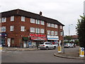
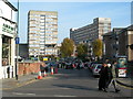
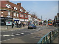
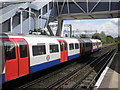
77 photos from this area
Area Information
Key information about the HA9 7AH including its size, population, and administrative classification.
- Area Type
- Postcode
- Area Size
- 1.1 hectares
- Population
- 2728
- Population Density
- 9532 people/km²
House Prices in HA9 7AH
34
Properties
£257,500
Average Sold Price
£257,500
Lowest Price
£257,500
Highest Price
Showing 34 properties
| Address | Type | Beds | Baths | Last Sale Price | Last Sale Date | |
|---|---|---|---|---|---|---|
| 302, Ramsey House, Central Square, Wembley, HA9 7AH | Flat | - | - | £257,500 | Oct 2014 | |
| 209, Ramsey House, Central Square, Wembley, HA9 7AH | Flat | 1 | 1 | - | - | |
| 15 Central Square, Wembley, HA9 7AH | shop | - | - | - | - | |
| 406, Ramsey House, Central Square, Wembley, HA9 7AH | Flat | - | - | - | - | |
| 306, Ramsey House, Central Square, Wembley, HA9 7AH | Flat | 1 | 1 | - | - | |
| 405, Ramsey House, Central Square, Wembley, HA9 7AH | Flat | - | - | - | - | |
| 307, Ramsey House, Central Square, Wembley, HA9 7AH | Flat | - | - | - | - | |
| 310, Ramsey House, Central Square, Wembley, HA9 7AH | Flat | - | - | - | - | |
| 202, Ramsey House, Central Square, Wembley, HA9 7AH | Flat | - | - | - | - | |
| 210, Ramsey House, Central Square, Wembley, HA9 7AH | Flat | 2 | 1 | - | - |
Page 1 of 4
Energy Efficiency in HA9 7AH
Amenities
Schools
| Rank | School | Type | Entry gender | Ages |
|---|
Explore more schools in this area
Go to Schools tabDemographics
Household Size
Family (3-5 people)
most common
Accommodation Type
Flats
most common
Tenure
27
majority
Ethnic Group
asian_total
most common
Religion
N/A
most common
Household Composition
N/A
most common
Age
47
median
Adults (30-64 years)
most common
Household Deprivation
N/A
with no deprivation
NS-SEC
23
in Lower managerial occupations
Explore more demographic insights in this area
Go to Demographics tabPlanning
Planning Constraints
- Flood RiskPremium
- Ramsar Wetland SitesPremium
- Area of Outstanding Natural BeautyPremium
- Protected Nature ReservePremium
- Protected WoodlandPremium