Area Overview for HA9 6LL
Photos of HA9 6LL
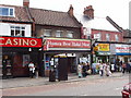
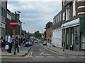
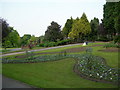
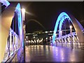
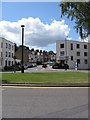
100 photos from this area
Area Information
Key information about the HA9 6LL including its size, population, and administrative classification.
- Area Type
- Postcode
- Area Size
- 4929 m²
- Population
- 2266
- Population Density
- 8368 people/km²
House Prices in HA9 6LL
15
Properties
£210,000
Average Sold Price
£5,000
Lowest Price
£620,000
Highest Price
Showing 15 properties
| Address | Type | Beds | Baths | Last Sale Price | Last Sale Date | |
|---|---|---|---|---|---|---|
| 308A Harrow Road, Wembley, HA9 6LL | Flat | 3 | 1 | £620,000 | Dec 2023 | |
| 304A Harrow Road, Wembley, HA9 6LL | Flat | - | - | £5,000 | Apr 2021 | |
| 306A Harrow Road, Wembley, HA9 6LL | Flat | - | - | £140,000 | Jan 2014 | |
| 300A Harrow Road, Wembley, HA9 6LL | Flat | - | - | £135,000 | Aug 2013 | |
| 302A Harrow Road, Wembley, HA9 6LL | Flat | 1 | - | £150,000 | Apr 2007 | |
| 322A Harrow Road, Wembley, HA9 6LL | Flat | - | 1 | - | - | |
| Former, 312A Harrow Road, Wembley, HA9 6LL | Flat | - | - | - | - | |
| Managers Flat, Forrmer Greyhound, 324 Harrow Road, Wembley, HA9 6LL | Flat | - | - | - | - | |
| Bed And Breakfast, 324 Harrow Road, Wembley, HA9 6LL | hotel | - | - | - | - | |
| Star Tours, 312 Harrow Road, Wembley, HA9 6LL | shop | - | - | - | - |
Page 1 of 2
Energy Efficiency in HA9 6LL
Amenities
Schools
| Rank | School | Type | Entry gender | Ages |
|---|
Explore more schools in this area
Go to Schools tabDemographics
Household Size
Family (3-5 people)
most common
Accommodation Type
Houses
most common
Tenure
40
majority
Ethnic Group
asian_total
most common
Religion
N/A
most common
Household Composition
N/A
most common
Age
47
median
Adults (30-64 years)
most common
Household Deprivation
N/A
with no deprivation
NS-SEC
26
in Lower managerial occupations
Explore more demographic insights in this area
Go to Demographics tabPlanning
Planning Constraints
- Flood RiskPremium
- Ramsar Wetland SitesPremium
- Area of Outstanding Natural BeautyPremium
- Protected Nature ReservePremium
- Protected WoodlandPremium