Area Overview for HA9 6EF
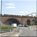
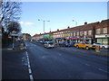
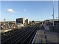
Photos of HA9 6EF


Area Information
HA9 6EF is a small, tightly knit residential postcode in England, home to around 2,600 people. Its compact size means it’s a quiet, low-density area where daily life revolves around local amenities and nearby transport hubs. The community here is predominantly middle-aged, with a median age of 47, and most residents are adults between 30 and 64. This suggests a stable population, likely with families and long-term residents. The area’s housing stock is primarily houses, which is unusual for urban zones, offering a more private, spacious living experience. Nearby, the postcode is within reach of major landmarks like Wembley Stadium and London Zoo, blending suburban comfort with urban accessibility. Residents benefit from proximity to multiple rail and metro stations, making commuting straightforward. While the area lacks large-scale retail or leisure hubs, its smaller shops and transport links cater to everyday needs. For buyers, HA9 6EF offers a mix of tranquillity and connectivity, though its limited size means choices are focused on immediate surroundings.
- Area Type
- Postcode
- Area Size
- Not available
- Population
- 2599
- Population Density
- 12196 people/km²
HA9 6EF’s property market is characterised by a 46% home ownership rate, which is lower than the national average, suggesting a significant proportion of properties are rented. The area’s housing stock is almost entirely composed of houses, which is atypical for urban or semi-urban zones. This likely reflects a focus on private, spacious homes rather than apartments or flats. For buyers, this means the available housing is limited to detached or semi-detached properties, which may appeal to those seeking larger living spaces but could restrict options for first-time buyers or those needing smaller units. The small size of the postcode means the immediate surroundings are crucial for property seekers, with nearby areas likely offering more variety. The predominance of houses also implies a quieter, less densely populated environment, which may be a draw for those prioritising privacy over proximity to city centres. However, the limited housing stock could lead to competition among buyers.
House Prices in HA9 6EF
No properties found in this postcode.
Energy Efficiency in HA9 6EF
HA9 6EF’s lifestyle is shaped by its proximity to retail, transport, and leisure facilities. Within walking distance are Sainsburys Wembley, Tesco Wembley, and M&S Wembley, providing everyday shopping needs. The area’s rail and metro stations connect to major landmarks like Wembley Stadium and London Zoo, making cultural and recreational activities easily accessible. Ferry services, including stops at Little Venice and London Zoo, add to the area’s connectivity. RAF Northolt, the nearest airport, is also within reach, though it serves military rather than civilian traffic. The mix of retail, transport, and green spaces suggests a balance between convenience and quiet living. However, the lack of large-scale leisure venues means residents may need to travel further for events or entertainment. Overall, the area offers practical amenities that support a functional, suburban lifestyle.
Amenities
Schools
HA9 6EF is served by a range of schools, including St Joseph’s Catholic Junior School and St Joseph’s Catholic Infant School, both rated ‘good’ by Ofsted. These primary schools provide a solid foundation for young children, with a focus on Catholic education. Nearby, Copland Community School offers additional primary education, though its Ofsted rating is not specified. For secondary education, Ark Elvin Academy is an outstanding-rated academy, indicating high standards in teaching and student outcomes. The mix of faith-based and state-run schools gives families flexibility in choosing education paths. The presence of multiple schools within walking distance suggests the area is family-friendly, with a focus on accessible, quality education. However, the lack of data on secondary school performance beyond Ark Elvin Academy means potential buyers should verify additional options.
| Rank | School | Type | Entry gender | Ages |
|---|
Explore more schools in this area
Go to Schools tabDemographics
The population of HA9 6EF is 2,599, with a median age of 47, indicating a mature, settled community. The majority of residents are adults aged 30–64, suggesting a balance between working professionals and families. Home ownership here is 46%, slightly below the national average, which points to a mix of owner-occupied properties and rental units. The area’s accommodation is predominantly houses, which may reflect a preference for single-family living. The predominant ethnic group is Asian, which influences the cultural fabric of the area. This demographic profile means the community is likely to have established social networks and a focus on long-term stability. However, the lack of data on deprivation or income levels means it’s unclear how economic factors shape quality of life. The presence of schools and transport links suggests the area is functional for families, though its small size may limit opportunities for those seeking diverse social or professional environments.
Household Size
Accommodation Type
Tenure
Ethnic Group
Religion
Household Composition
Age
Household Deprivation
NS-SEC
Explore more demographic insights in this area
Go to Demographics tabPlanning
Planning Constraints
- Flood RiskPremium
- Ramsar Wetland SitesPremium
- Area of Outstanding Natural BeautyPremium
- Protected Nature ReservePremium
- Protected WoodlandPremium