Area Overview for HA8 9RA
Photos of HA8 9RA
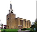
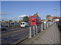
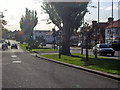
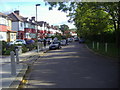
100 photos from this area
Area Information
Key information about the HA8 9RA including its size, population, and administrative classification.
- Area Type
- Postcode
- Area Size
- 1.1 hectares
- Population
- 1871
- Population Density
- 6270 people/km²
House Prices in HA8 9RA
28
Properties
£418,225
Average Sold Price
£110,000
Lowest Price
£745,000
Highest Price
Showing 28 properties
| Address | Type | Beds | Baths | Last Sale Price | Last Sale Date | |
|---|---|---|---|---|---|---|
| 35 Upcroft Avenue, Edgware, HA8 9RA | Detached | 4 | 2 | £720,000 | Jul 2025 | |
| 39 Upcroft Avenue, Edgware, HA8 9RA | Semi-detached | 3 | 1 | £622,000 | May 2025 | |
| 51 Upcroft Avenue, Edgware, HA8 9RA | Semi-detached | 4 | 2 | £745,000 | Dec 2020 | |
| 37 Upcroft Avenue, Edgware, HA8 9RA | Semi-detached | 4 | 1 | £675,000 | Mar 2016 | |
| 23 Upcroft Avenue, Edgware, HA8 9RA | Semi-detached | 5 | 2 | £685,000 | Nov 2015 | |
| 19 Upcroft Avenue, Edgware, HA8 9RA | Semi-detached | 3 | 1 | £455,000 | Dec 2012 | |
| 29 Upcroft Avenue, Edgware, HA8 9RA | house | 4 | - | £500,000 | Jan 2012 | |
| 11 Upcroft Avenue, Edgware, HA8 9RA | house | - | - | £432,000 | Sep 2009 | |
| 1 Upcroft Avenue, Edgware, HA8 9RA | Semi-detached | 3 | 1 | £295,000 | May 2009 | |
| 15 Upcroft Avenue, Edgware, HA8 9RA | Semi-detached | 4 | 2 | £365,000 | Apr 2009 |
Page 1 of 3
Energy Efficiency in HA8 9RA
Amenities
Schools
| Rank | School | Type | Entry gender | Ages |
|---|
Explore more schools in this area
Go to Schools tabDemographics
Household Size
Family (3-5 people)
most common
Accommodation Type
Houses
most common
Tenure
67
majority
Ethnic Group
White
most common
Religion
N/A
most common
Household Composition
N/A
most common
Age
47
median
Adults (30-64 years)
most common
Household Deprivation
N/A
with no deprivation
NS-SEC
43
in Lower managerial occupations
Explore more demographic insights in this area
Go to Demographics tabPlanning
Planning Constraints
- Flood RiskPremium
- Ramsar Wetland SitesPremium
- Area of Outstanding Natural BeautyPremium
- Protected Nature ReservePremium
- Protected WoodlandPremium