Area Overview for HA8 9JG
Photos of HA8 9JG

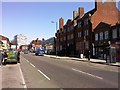
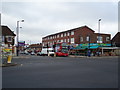
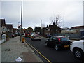
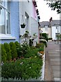
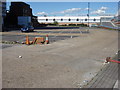
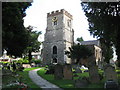
100 photos from this area
Area Information
Key information about the HA8 9JG including its size, population, and administrative classification.
- Area Type
- Postcode
- Area Size
- 6379 m²
- Population
- 1735
- Population Density
- 10029 people/km²
House Prices in HA8 9JG
27
Properties
£211,900
Average Sold Price
£62,000
Lowest Price
£430,000
Highest Price
Showing 27 properties
| Address | Type | Beds | Baths | Last Sale Price | Last Sale Date | |
|---|---|---|---|---|---|---|
| 47 Wenlock Road, Edgware, HA8 9JG | Maisonette | - | - | £220,000 | Aug 2025 | |
| 5 Wenlock Road, Edgware, HA8 9JG | Terraced | 3 | 1 | £430,000 | May 2017 | |
| 25 Wenlock Road, Edgware, HA8 9JG | Terraced | 1 | 1 | £340,000 | Sep 2016 | |
| 33 Wenlock Road, Edgware, HA8 9JG | house | 3 | 1 | £247,500 | Oct 2015 | |
| 41 Wenlock Road, Edgware, HA8 9JG | house | 3 | 1 | £285,000 | Jun 2012 | |
| 45 Wenlock Road, Edgware, HA8 9JG | house | - | - | £196,000 | Apr 2004 | |
| 3 Wenlock Road, Edgware, HA8 9JG | Terraced | 3 | 1 | £145,000 | Jul 2001 | |
| 31 Wenlock Road, Edgware, HA8 9JG | Terraced | - | - | £114,000 | Oct 2000 | |
| 13 Wenlock Road, Edgware, HA8 9JG | house | - | - | £79,500 | Oct 1998 | |
| 21 Wenlock Road, Edgware, HA8 9JG | Semi-detached | 4 | 1 | £62,000 | Aug 1995 |
Page 1 of 3
Energy Efficiency in HA8 9JG
Amenities
Schools
| Rank | School | Type | Entry gender | Ages |
|---|
Explore more schools in this area
Go to Schools tabDemographics
Household Size
Family (3-5 people)
most common
Accommodation Type
Houses
most common
Tenure
42
majority
Ethnic Group
White
most common
Religion
N/A
most common
Household Composition
N/A
most common
Age
47
median
Adults (30-64 years)
most common
Household Deprivation
N/A
with no deprivation
NS-SEC
22
in Lower managerial occupations
Explore more demographic insights in this area
Go to Demographics tabPlanning
Planning Constraints
- Flood RiskPremium
- Ramsar Wetland SitesPremium
- Area of Outstanding Natural BeautyPremium
- Protected Nature ReservePremium
- Protected WoodlandPremium