Area Overview for HA8 7RL
Photos of HA8 7RL


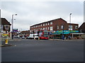
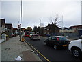
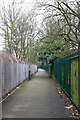
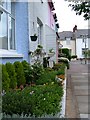
100 photos from this area
Area Information
Key information about the HA8 7RL including its size, population, and administrative classification.
- Area Type
- Postcode
- Area Size
- 1.1 hectares
- Population
- 1590
- Population Density
- 5215 people/km²
House Prices in HA8 7RL
65
Properties
£390,454
Average Sold Price
£58,750
Lowest Price
£574,000
Highest Price
Showing 65 properties
| Address | Type | Beds | Baths | Last Sale Price | Last Sale Date | |
|---|---|---|---|---|---|---|
| 59 Lodge Close, Edgware, HA8 7RL | Flat | 3 | 2 | £485,000 | Jan 2025 | |
| 25 Lodge Close, Edgware, HA8 7RL | Flat | - | - | £450,000 | Jun 2024 | |
| 47 Lodge Close, Edgware, HA8 7RL | Flat | - | - | £490,000 | Mar 2024 | |
| 38 Lodge Close, Edgware, HA8 7RL | Flat | - | - | £460,000 | Dec 2023 | |
| 29 Lodge Close, Edgware, HA8 7RL | Flat | - | - | £465,000 | Dec 2023 | |
| 12 Lodge Close, Edgware, HA8 7RL | Flat | 3 | 2 | £460,000 | Apr 2023 | |
| 63 Lodge Close, Edgware, HA8 7RL | Flat | 1 | 1 | £450,000 | Mar 2023 | |
| 58 Lodge Close, Edgware, HA8 7RL | Flat | 3 | 2 | £495,000 | Dec 2022 | |
| 21 Lodge Close, Edgware, HA8 7RL | Flat | 2 | 1 | £420,000 | Oct 2022 | |
| 14 Lodge Close, Edgware, HA8 7RL | Flat | 3 | 2 | £500,000 | Sep 2022 |
Page 1 of 7
Energy Efficiency in HA8 7RL
Amenities
Schools
| Rank | School | Type | Entry gender | Ages |
|---|
Explore more schools in this area
Go to Schools tabDemographics
Household Size
Family (3-5 people)
most common
Accommodation Type
Houses
most common
Tenure
74
majority
Ethnic Group
White
most common
Religion
N/A
most common
Household Composition
N/A
most common
Age
47
median
Adults (30-64 years)
most common
Household Deprivation
N/A
with no deprivation
NS-SEC
43
in Lower managerial occupations
Explore more demographic insights in this area
Go to Demographics tabPlanning
Planning Constraints
- Flood RiskPremium
- Ramsar Wetland SitesPremium
- Area of Outstanding Natural BeautyPremium
- Protected Nature ReservePremium
- Protected WoodlandPremium