Area Overview for HA8 7JL
Photos of HA8 7JL


Area Information
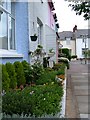
HA8 7JL is a compact residential postcode in England, covering 501 square metres and home to 1997 residents. Its high population density of 3,988,856 people per square kilometre reflects a tightly knit community, though the area’s small size means it is a focused cluster rather than a sprawling suburb. Living here offers proximity to essential services, with five metro stations—including Edgware and Burnt Oak—within practical reach. The area is characterised by a mix of housing types, though the data suggests a predominance of houses over flats. Families and professionals may find the balance between residential tranquillity and urban connectivity appealing. With nearby schools, retail hubs, and rail links, HA8 7JL caters to daily needs without requiring long commutes. The low crime risk and absence of environmental constraints like protected woodlands or AONB designations add to its practicality. For those seeking a manageable, well-served area with a distinct local identity, HA8 7JL presents a viable option.
- Area Type
- Postcode
- Area Size
- 501 m²
- Population
- 1997
- Population Density
- 7032 people/km²
HA8 7JL’s property market is shaped by its 55% home ownership rate, suggesting a balance between owner-occupied homes and rental properties. The accommodation type is predominantly houses, which may appeal to families or those seeking more space than flats. Given the area’s small size, the housing stock is likely limited, making it a niche market for buyers. The high population density implies that properties are closely spaced, potentially affecting both privacy and property values. For buyers, the focus on houses may mean fewer high-rise developments or shared ownership schemes. The absence of data on property prices or recent transactions means that market trends remain opaque, but the presence of nearby amenities and transport links could support long-term value. Those considering HA8 7JL should weigh the compact nature of the area against its accessibility to services and infrastructure.
House Prices in HA8 7JL
Showing 1 properties
| Address | Type | Beds | Baths | Last Sale Price | Last Sale Date | |
|---|---|---|---|---|---|---|
| 111 Station Road, The Hale, Edgware, HA8 7JL | Flat | - | - | - | - |
Energy Efficiency in HA8 7JL
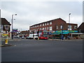
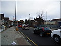
Daily life in HA8 7JL is shaped by its proximity to essential amenities. Residents have access to five metro stations, including Edgware and Canons Park, and five rail stations such as Elstree & Borehamwood, facilitating easy travel to nearby towns. Retail options are plentiful, with Iceland, Sainsburys, and Tesco in Edgware providing groceries and household goods. While the area’s small size means parks or leisure facilities are not explicitly listed in the data, the presence of multiple transport hubs suggests nearby green spaces or recreational areas are accessible. The compact nature of HA8 7JL fosters a localised lifestyle, where community interactions and convenience are prioritised. For those valuing proximity to shops, transport, and schools, the area offers a practical, if limited, range of amenities that cater to daily needs.
Amenities
Schools
HA8 7JL is served by three notable schools. Langdon College is a special school, catering to students with specific educational needs. Edgware Jewish Girls – Beis Chinuch is an independent school with a good Ofsted rating, offering a faith-based education. Beit Shvidler Primary School, also rated good by Ofsted, provides early years and primary education. The mix of school types ensures options for both state and independent education, though the absence of data on school catchment areas or pupil numbers means potential applicants must verify suitability. Families seeking a range of educational pathways may find this diversity advantageous, though the area’s small size could limit the number of available places. The proximity of these schools to HA8 7JL underscores the area’s appeal to households prioritising quality education.
| Rank | School | Type | Entry gender | Ages |
|---|
Explore more schools in this area
Go to Schools tabDemographics
The population of HA8 7JL has a median age of 47, with the most common age range being adults aged 30–64. This suggests a mature, stable community, likely with established households. Home ownership rates stand at 55%, indicating a mix of owner-occupied properties and rental units. The predominant accommodation type is houses, which may reflect a preference for family homes or larger living spaces. The predominant ethnic group is White, though the data does not specify further diversity metrics. The high population density—3,988,856 people per square kilometre—raises questions about living space per person, though the area’s small size means this density is concentrated within a limited footprint. For residents, this density could mean a close-knit environment with shared amenities, though it may also influence property availability and pricing.
Household Size
Accommodation Type
Tenure
Ethnic Group
Religion
Household Composition
Age
Household Deprivation
NS-SEC
Explore more demographic insights in this area
Go to Demographics tabPlanning
Planning Constraints
- Flood RiskPremium
- Ramsar Wetland SitesPremium
- Area of Outstanding Natural BeautyPremium
- Protected Nature ReservePremium
- Protected WoodlandPremium