Area Overview for HA8 6ER
Photos of HA8 6ER

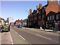
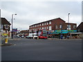
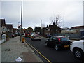
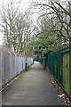
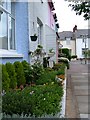
100 photos from this area
Area Information
Key information about the HA8 6ER including its size, population, and administrative classification.
- Area Type
- Postcode
- Area Size
- 3326 m²
- Population
- 2508
- Population Density
- 10727 people/km²
House Prices in HA8 6ER
11
Properties
£283,429
Average Sold Price
£200,000
Lowest Price
£380,000
Highest Price
Showing 11 properties
| Address | Type | Beds | Baths | Last Sale Price | Last Sale Date | |
|---|---|---|---|---|---|---|
| 58A Camrose Avenue, Edgware, HA8 6ER | Terraced | - | - | £380,000 | Apr 2016 | |
| 72 Camrose Avenue, Edgware, HA8 6ER | house | - | - | £350,000 | Aug 2012 | |
| 74 Camrose Avenue, Edgware, HA8 6ER | house | - | - | £285,000 | Oct 2009 | |
| 60 Camrose Avenue, Edgware, HA8 6ER | Terraced | - | - | £280,000 | Aug 2005 | |
| 68 Camrose Avenue, Edgware, HA8 6ER | house | - | - | £267,000 | Apr 2005 | |
| 64 Camrose Avenue, Edgware, HA8 6ER | house | - | - | £222,000 | Aug 2002 | |
| 70 Camrose Avenue, Edgware, HA8 6ER | Maisonette | 2 | 1 | £200,000 | Jun 2002 | |
| 76 Camrose Avenue, Edgware, HA8 6ER | house | - | - | - | - | |
| 66 Camrose Avenue, Edgware, HA8 6ER | Semi-detached | - | - | - | - | |
| 58 Camrose Avenue, Edgware, HA8 6ER | Terraced | - | - | - | - |
Page 1 of 2
Energy Efficiency in HA8 6ER
Amenities
Schools
| Rank | School | Type | Entry gender | Ages |
|---|
Explore more schools in this area
Go to Schools tabDemographics
Household Size
Family (3-5 people)
most common
Accommodation Type
Flats
most common
Tenure
49
majority
Ethnic Group
White
most common
Religion
N/A
most common
Household Composition
N/A
most common
Age
47
median
Adults (30-64 years)
most common
Household Deprivation
N/A
with no deprivation
NS-SEC
29
in Lower managerial occupations
Explore more demographic insights in this area
Go to Demographics tabPlanning
Planning Constraints
- Flood RiskPremium
- Ramsar Wetland SitesPremium
- Area of Outstanding Natural BeautyPremium
- Protected Nature ReservePremium
- Protected WoodlandPremium