Area Overview for HA7 4RE
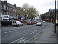
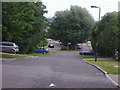
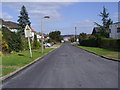
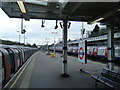
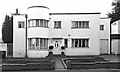
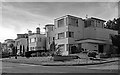
Photos of HA7 4RE


Area Information
HA7 4RE is a small, densely populated residential cluster in England, covering 7,525 square metres and home to 1,560 residents. With a population density of 207,313 people per square kilometre, this area is compact but well-served by essential amenities. Daily life here is shaped by its proximity to transport hubs and local services, making it practical for commuters and families alike. The area’s character is defined by its mix of housing types and the presence of nearby schools, which cater to a predominantly adult population. While the high density means limited space, the community benefits from accessible retail, public transport, and low crime rates. Residents here are likely to value convenience over space, with a focus on connectivity to nearby towns and cities. The area’s small size means it’s best suited for those prioritising proximity to services over expansive living quarters, though its practicality and safety make it appealing for a range of lifestyles.
- Area Type
- Postcode
- Area Size
- 7525 m²
- Population
- 1560
- Population Density
- 2535 people/km²
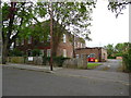
The property market in HA7 4RE is characterised by a high rate of home ownership (62%) and a focus on houses. This suggests a community of long-term residents who prioritise stability over rental flexibility. The predominance of houses may indicate a mix of semi-detached and terraced properties, typical of smaller residential clusters. Given the area’s compact size, the housing stock is likely limited, meaning buyers may need to consider nearby areas for more options. The high home ownership rate also implies strong local demand, which could influence property values. For buyers, this area offers a practical alternative to larger towns, with the advantage of proximity to transport and amenities. However, the small footprint means competition for available properties, and potential buyers should assess the surrounding areas for additional choices.
House Prices in HA7 4RE
No properties found in this postcode.
Energy Efficiency in HA7 4RE
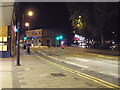
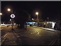
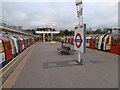
Living in HA7 4RE offers a practical lifestyle with access to essential amenities. Retailers like Lidl Stanmore, Tesco Edgware Canons, and Sainsburys Stanmore provide grocery and daily shopping needs within walking distance. The area’s five metro stations, including Stanmore and Canons Park, connect residents to wider transport networks, while rail links to Mill Hill and Elstree facilitate commuting. Though there is no mention of parks or leisure facilities in the data, the proximity to Edgware and Stanmore suggests access to green spaces and community hubs in nearby towns. The compact nature of HA7 4RE means residents can reach shops, transport, and services quickly, fostering a convenient, efficient lifestyle. This balance of accessibility and density makes it ideal for those prioritising functionality over expansive living spaces.
Amenities
Schools
Residents of HA7 4RE have access to Aylward Primary School, which serves the local community and holds a ‘good’ Ofsted rating. This state-funded primary school is a key asset for families with young children. Nearby, North London Collegiate School offers independent education, providing an alternative for those seeking private schooling. The combination of state and independent options reflects the area’s appeal to a range of families, from those prioritising affordability to those seeking specialist education. Both institutions are within practical reach, reducing the need for long commutes. The presence of a well-rated primary school, in particular, enhances the area’s desirability for families, as it ensures accessible, high-quality early education. For parents, this mix of school types offers flexibility to align with their children’s needs and financial circumstances.
| Rank | School | Type | Entry gender | Ages |
|---|
Explore more schools in this area
Go to Schools tabDemographics
The population of HA7 4RE has a median age of 47, with the majority of residents aged between 30 and 64. This suggests a community of established professionals and families, rather than a younger or elderly demographic. Home ownership is high at 62%, indicating a stable, long-term resident base. The accommodation type is predominantly houses, which aligns with the area’s compact size and suggests a mix of semi-detached and terraced properties. The predominant ethnic group is White, though no specific diversity data is provided. The high population density—207,313 people per square kilometre—means living space is limited, which may influence housing availability and prices. For quality of life, the low crime risk and proximity to schools and transport suggest a balanced environment, though the area’s small size may limit opportunities for expansion or new developments.
Household Size
Accommodation Type
Tenure
Ethnic Group
Religion
Household Composition
Age
Household Deprivation
NS-SEC
Explore more demographic insights in this area
Go to Demographics tabPlanning
Planning Constraints
- Flood RiskPremium
- Ramsar Wetland SitesPremium
- Area of Outstanding Natural BeautyPremium
- Protected Nature ReservePremium
- Protected WoodlandPremium