Area Overview for HA7 4PT
Photos of HA7 4PT

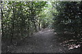
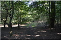
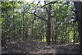
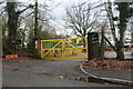
27 photos from this area
Area Information
Key information about the HA7 4PT including its size, population, and administrative classification.
- Area Type
- Postcode
- Area Size
- 7.6 hectares
- Population
- 1994
- Population Density
- 2546 people/km²
House Prices in HA7 4PT
16
Properties
£1,222,100
Average Sold Price
£650,000
Lowest Price
£1,878,000
Highest Price
Showing 16 properties
| Address | Type | Beds | Baths | Last Sale Price | Last Sale Date | |
|---|---|---|---|---|---|---|
| 5 Augustus Close, Stanmore, HA7 4PT | house | - | - | £1,878,000 | Apr 2022 | |
| 14 Augustus Close, Stanmore, HA7 4PT | house | 6 | - | £1,865,000 | May 2021 | |
| 8 Augustus Close, Stanmore, HA7 4PT | Detached | 5 | - | £1,416,000 | Sep 2015 | |
| 12 Augustus Close, Stanmore, HA7 4PT | Detached | 6 | - | £1,150,000 | Jul 2012 | |
| 3 Augustus Close, Stanmore, HA7 4PT | house | 5 | - | £1,250,000 | Jun 2012 | |
| 2 Augustus Close, Stanmore, HA7 4PT | Detached | 5 | 3 | £1,075,000 | Aug 2009 | |
| 1 Augustus Close, Stanmore, HA7 4PT | Detached | 5 | 3 | £1,100,000 | Aug 2007 | |
| 9 Augustus Close, Stanmore, HA7 4PT | Detached | - | - | £1,350,000 | Jan 2006 | |
| 13 Augustus Close, Stanmore, HA7 4PT | Detached | 5 | 3 | £1,200,000 | Dec 2005 | |
| 10 Augustus Close, Stanmore, HA7 4PT | Detached | 5 | 3 | £1,200,000 | Dec 2005 |
Page 1 of 2
Energy Efficiency in HA7 4PT
Amenities
Schools
| Rank | School | Type | Entry gender | Ages |
|---|
Explore more schools in this area
Go to Schools tabDemographics
Household Size
Family (3-5 people)
most common
Accommodation Type
Houses
most common
Tenure
70
majority
Ethnic Group
asian_total
most common
Religion
N/A
most common
Household Composition
N/A
most common
Age
47
median
Adults (30-64 years)
most common
Household Deprivation
N/A
with no deprivation
NS-SEC
46
in Lower managerial occupations
Explore more demographic insights in this area
Go to Demographics tabPlanning
Planning Constraints
- Flood RiskPremium
- Ramsar Wetland SitesPremium
- Area of Outstanding Natural BeautyPremium
- Protected Nature ReservePremium
- Protected WoodlandPremium