Area Overview for HA7 4DP
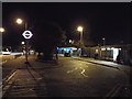
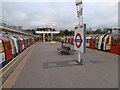
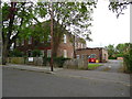
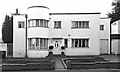
Photos of HA7 4DP


Area Information
Living in HA7 4DP offers a compact, residential experience with a population of 2,623 residents. This small postcode area is characterised by its cluster of flats, reflecting a community that prioritises convenience and proximity to essential services. The area’s median age of 47 suggests a stable demographic, with adults aged 30–64 forming the largest group. Daily life here is shaped by practicality: nearby schools, retail hubs, and transport links create a self-contained environment. The presence of multiple supermarkets like Sainsburys Stanmore and Lidl Stanmore, along with accessible rail and metro stations, ensures residents have easy access to shopping, commuting, and leisure. While the area lacks sprawling green spaces, its proximity to Stanmore and Edgware stations connects it to broader London networks. Broadband and mobile connectivity scores of 81 and 85 respectively support remote work and digital lifestyles. HA7 4DP is not a place for those seeking sprawling estates or rural tranquillity—it is a focused, functional postcode ideal for those valuing accessibility over acreage.
- Area Type
- Postcode
- Area Size
- Not available
- Population
- 2623
- Population Density
- 4303 people/km²
The property market in HA7 4DP is defined by its high proportion of flats, with 61% of homes owner-occupied. This suggests a community where residents are likely to have lived in their properties for extended periods, contributing to a sense of continuity. The compact nature of the postcode means the housing stock is limited, with little scope for new developments. Flats dominate, which may appeal to buyers seeking low-maintenance living or those needing space-efficient properties. The area’s proximity to transport hubs like Stanmore Station and Edgware makes it attractive to commuters, though the small size of HA7 4DP means buyers must consider nearby postcodes for larger homes. For those prioritising convenience over space, this area offers a practical, if modest, housing option.
House Prices in HA7 4DP
No properties found in this postcode.
Energy Efficiency in HA7 4DP
The lifestyle in HA7 4DP is shaped by its proximity to retail and transport hubs. Supermarkets such as Sainsburys Stanmore, Lidl Stanmore, and Tesco Edgware Canons provide everyday shopping needs, while the area’s metro and rail stations connect residents to broader leisure and employment opportunities. Although the postcode itself is small, the surrounding area includes multiple retail outlets and transport links, ensuring convenience for daily errands and commuting. Parks and open spaces are not explicitly listed, but the absence of protected natural areas suggests a focus on urban living. The community’s access to schools, shops, and transport makes HA7 4DP a practical choice for those prioritising accessibility over expansive green spaces. Daily life here is defined by efficiency, with amenities within practical reach.
Amenities
Schools
HA7 4DP is served by three primary schools: St John’s CofE First School, St John’s CofE Middle School, and St John’s CofE School, which holds an Ofsted rating of ‘good’. This concentration of primary education options provides families with multiple choices for their children’s early education. The presence of three schools within the area suggests a strong focus on local schooling, reducing the need for long commutes to secondary institutions. While no secondary schools are listed, the proximity to Stanmore and Edgware stations could ease access to larger educational hubs. The ‘good’ rating at St John’s CofE School indicates a reliable standard of teaching, though parents may still need to evaluate each school’s specific offerings. For families prioritising accessible, early education, HA7 4DP offers a solid foundation.
| Rank | School | Type | Entry gender | Ages |
|---|
Explore more schools in this area
Go to Schools tabDemographics
HA7 4DP’s population of 2,623 is predominantly composed of adults aged 30–64, with a median age of 47. This suggests a mature, settled community, likely with strong family ties and established careers. Home ownership stands at 61%, indicating a mix of owner-occupied properties and rental units. The area’s accommodation is largely flats, reflecting a housing stock tailored to smaller households or those prioritising maintenance-free living. The predominant ethnic group is White, though no specific diversity statistics are provided. The absence of data on deprivation or income levels means the area’s economic profile remains opaque. However, the presence of three primary schools and multiple retail outlets suggests a balance between community needs and infrastructure. For those considering HA7 4DP, the demographic profile points to a stable, low-turnover environment where residents may have long-term ties to the area.
Household Size
Accommodation Type
Tenure
Ethnic Group
Religion
Household Composition
Age
Household Deprivation
NS-SEC
Explore more demographic insights in this area
Go to Demographics tabPlanning
Planning Constraints
- Flood RiskPremium
- Ramsar Wetland SitesPremium
- Area of Outstanding Natural BeautyPremium
- Protected Nature ReservePremium
- Protected WoodlandPremium