Area Overview for HA7 3RU
Photos of HA7 3RU
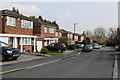
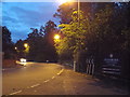
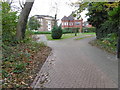
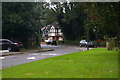
32 photos from this area
Area Information
Key information about the HA7 3RU including its size, population, and administrative classification.
- Area Type
- Postcode
- Area Size
- 3584 m²
- Population
- 1838
- Population Density
- 4274 people/km²
House Prices in HA7 3RU
8
Properties
£546,600
Average Sold Price
£275,000
Lowest Price
£1,105,000
Highest Price
Showing 8 properties
| Address | Type | Beds | Baths | Last Sale Price | Last Sale Date | |
|---|---|---|---|---|---|---|
| 33 The Chase, Stanmore, HA7 3RU | Detached | 5 | 2 | £1,105,000 | May 2023 | |
| 29 The Chase, Stanmore, HA7 3RU | Detached | 3 | 1 | £408,000 | May 2008 | |
| 25 The Chase, Stanmore, HA7 3RU | Terraced | - | - | £550,000 | Mar 2008 | |
| 27 The Chase, Stanmore, HA7 3RU | Detached | 4 | 2 | £395,000 | Feb 2008 | |
| 23 The Chase, Stanmore, HA7 3RU | Detached | - | - | £275,000 | Sep 1997 | |
| 31 The Chase, Stanmore, HA7 3RU | Terraced | - | - | - | - | |
| 21 The Chase, Stanmore, HA7 3RU | Terraced | - | - | - | - | |
| 19 The Chase, Stanmore, HA7 3RU | Terraced | - | - | - | - |
Energy Efficiency in HA7 3RU
Amenities
Schools
| Rank | School | Type | Entry gender | Ages |
|---|
Explore more schools in this area
Go to Schools tabDemographics
Household Size
Family (3-5 people)
most common
Accommodation Type
Houses
most common
Tenure
83
majority
Ethnic Group
asian_total
most common
Religion
N/A
most common
Household Composition
N/A
most common
Age
47
median
Adults (30-64 years)
most common
Household Deprivation
N/A
with no deprivation
NS-SEC
42
in Lower managerial occupations
Explore more demographic insights in this area
Go to Demographics tabPlanning
Planning Constraints
- Flood RiskPremium
- Ramsar Wetland SitesPremium
- Area of Outstanding Natural BeautyPremium
- Protected Nature ReservePremium
- Protected WoodlandPremium