Area Overview for HA7 3ND
Photos of HA7 3ND
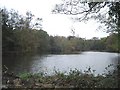
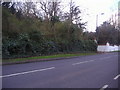
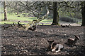
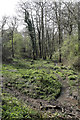
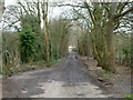
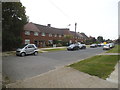
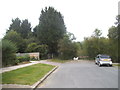
24 photos from this area
Area Information
Key information about the HA7 3ND including its size, population, and administrative classification.
- Area Type
- Postcode
- Area Size
- 8813 m²
- Population
- 2275
- Population Density
- 6959 people/km²
House Prices in HA7 3ND
26
Properties
£366,371
Average Sold Price
£120,000
Lowest Price
£820,000
Highest Price
Showing 26 properties
| Address | Type | Beds | Baths | Last Sale Price | Last Sale Date | |
|---|---|---|---|---|---|---|
| 15 Binyon Crescent, Stanmore, HA7 3ND | house | 4 | 3 | £820,000 | Oct 2025 | |
| 29 Binyon Crescent, Stanmore, HA7 3ND | Semi-detached | 4 | 2 | £618,000 | May 2022 | |
| 17 Binyon Crescent, Stanmore, HA7 3ND | Semi-detached | 3 | 1 | £675,000 | Jun 2021 | |
| 23 Binyon Crescent, Stanmore, HA7 3ND | house | - | - | £475,000 | Apr 2018 | |
| 35A Binyon Crescent, Stanmore, HA7 3ND | Flat | - | - | £156,000 | Jun 2015 | |
| 5 Binyon Crescent, Stanmore, HA7 3ND | house | 3 | - | £338,000 | May 2012 | |
| 1 Binyon Crescent, Stanmore, HA7 3ND | house | - | - | £330,000 | Aug 2011 | |
| 11 Binyon Crescent, Stanmore, HA7 3ND | house | - | - | £264,000 | Dec 2009 | |
| 3 Binyon Crescent, Stanmore, HA7 3ND | Semi-detached | - | - | £230,000 | Feb 2005 | |
| 9 Binyon Crescent, Stanmore, HA7 3ND | Semi-detached | - | - | £249,950 | Jun 2004 |
Page 1 of 3
Energy Efficiency in HA7 3ND
Amenities
Schools
| Rank | School | Type | Entry gender | Ages |
|---|
Explore more schools in this area
Go to Schools tabDemographics
Household Size
Family (3-5 people)
most common
Accommodation Type
Houses
most common
Tenure
41
majority
Ethnic Group
asian_total
most common
Religion
N/A
most common
Household Composition
N/A
most common
Age
47
median
Adults (30-64 years)
most common
Household Deprivation
N/A
with no deprivation
NS-SEC
21
in Lower managerial occupations
Explore more demographic insights in this area
Go to Demographics tabPlanning
Planning Constraints
- Flood RiskPremium
- Ramsar Wetland SitesPremium
- Area of Outstanding Natural BeautyPremium
- Protected Nature ReservePremium
- Protected WoodlandPremium