Area Overview for HA7 3EG
Photos of HA7 3EG


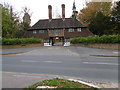
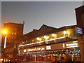

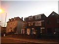
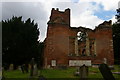
86 photos from this area
Area Information
Key information about the HA7 3EG including its size, population, and administrative classification.
- Area Type
- Postcode
- Area Size
- 3.3 hectares
- Population
- 1751
- Population Density
- 860 people/km²
House Prices in HA7 3EG
11
Properties
£1,669,375
Average Sold Price
£565,000
Lowest Price
£2,870,000
Highest Price
Showing 11 properties
| Address | Type | Beds | Baths | Last Sale Price | Last Sale Date | |
|---|---|---|---|---|---|---|
| 6 Aylmer Drive, Stanmore, HA7 3EG | Detached | 5 | 2 | £755,000 | Apr 2024 | |
| 28 Aylmer Drive, Stanmore, HA7 3EG | Retail | 5 | 4 | £2,750,000 | Dec 2022 | |
| 10 Aylmer Drive, Stanmore, HA7 3EG | Detached | 5 | 2 | £2,870,000 | Dec 2021 | |
| 30 Aylmer Drive, Stanmore, HA7 3EG | Detached | 6 | 4 | £1,750,000 | Jan 2020 | |
| 26 Aylmer Drive, Stanmore, HA7 3EG | house | - | - | £1,999,999 | Oct 2012 | |
| 12 Aylmer Drive, Stanmore, HA7 3EG | Detached | - | - | £1,900,000 | Aug 2012 | |
| 18 Aylmer Drive, Stanmore, HA7 3EG | Detached | 4 | 2 | £765,000 | Sep 2004 | |
| 24 Aylmer Drive, Stanmore, HA7 3EG | Detached | 5 | 2 | £565,000 | Jul 1999 | |
| 32 Aylmer Drive, Stanmore, HA7 3EG | Detached | 4 | 2 | - | - | |
| 22 Aylmer Drive, Stanmore, HA7 3EG | Detached | 5 | 2 | - | - |
Page 1 of 2
Energy Efficiency in HA7 3EG
Amenities
Schools
| Rank | School | Type | Entry gender | Ages |
|---|
Explore more schools in this area
Go to Schools tabDemographics
Household Size
Two person
most common
Accommodation Type
Houses
most common
Tenure
83
majority
Ethnic Group
White
most common
Religion
N/A
most common
Household Composition
N/A
most common
Age
47
median
Adults (30-64 years)
most common
Household Deprivation
N/A
with no deprivation
NS-SEC
46
in Lower managerial occupations
Explore more demographic insights in this area
Go to Demographics tabPlanning
Planning Constraints
- Flood RiskPremium
- Ramsar Wetland SitesPremium
- Area of Outstanding Natural BeautyPremium
- Protected Nature ReservePremium
- Protected WoodlandPremium