Area Overview for HA7 2HH
Photos of HA7 2HH

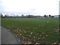
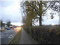
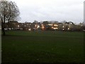
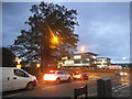

47 photos from this area
Area Information
Key information about the HA7 2HH including its size, population, and administrative classification.
- Area Type
- Postcode
- Area Size
- 8436 m²
- Population
- 1664
- Population Density
- 6834 people/km²
House Prices in HA7 2HH
20
Properties
£331,068
Average Sold Price
£110,000
Lowest Price
£595,000
Highest Price
Showing 20 properties
| Address | Type | Beds | Baths | Last Sale Price | Last Sale Date | |
|---|---|---|---|---|---|---|
| 95 Wetheral Drive, Stanmore, HA7 2HH | Semi-detached | 3 | 1 | £567,500 | Apr 2021 | |
| 99 Wetheral Drive, Stanmore, HA7 2HH | house | - | - | £212,000 | Feb 2017 | |
| 107 Wetheral Drive, Stanmore, HA7 2HH | Semi-detached | 3 | 1 | £595,000 | Oct 2016 | |
| 85 Wetheral Drive, Stanmore, HA7 2HH | house | 5 | 3 | £540,000 | Jun 2014 | |
| 93 Wetheral Drive, Stanmore, HA7 2HH | Semi-detached | 3 | 1 | £400,000 | Aug 2013 | |
| 117 Wetheral Drive, Stanmore, HA7 2HH | Terraced | - | - | £350,000 | Jul 2012 | |
| 101 Wetheral Drive, Stanmore, HA7 2HH | Semi-detached | 3 | 1 | £345,500 | May 2012 | |
| 89 Wetheral Drive, Stanmore, HA7 2HH | Terraced | - | - | £400,000 | Jul 2011 | |
| 115 Wetheral Drive, Stanmore, HA7 2HH | house | 3 | - | £290,000 | Feb 2010 | |
| 91 Wetheral Drive, Stanmore, HA7 2HH | house | - | - | £315,000 | Dec 2004 |
Page 1 of 2
Energy Efficiency in HA7 2HH
Amenities
Schools
| Rank | School | Type | Entry gender | Ages |
|---|
Explore more schools in this area
Go to Schools tabDemographics
Household Size
Family (3-5 people)
most common
Accommodation Type
Houses
most common
Tenure
78
majority
Ethnic Group
asian_total
most common
Religion
N/A
most common
Household Composition
N/A
most common
Age
47
median
Adults (30-64 years)
most common
Household Deprivation
N/A
with no deprivation
NS-SEC
39
in Lower managerial occupations
Explore more demographic insights in this area
Go to Demographics tabPlanning
Planning Constraints
- Flood RiskPremium
- Ramsar Wetland SitesPremium
- Area of Outstanding Natural BeautyPremium
- Protected Nature ReservePremium
- Protected WoodlandPremium