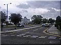
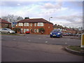
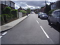
Area Overview for HA7 1NN
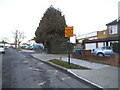
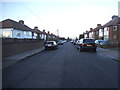
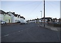
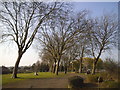
Photos of HA7 1NN
Area Information
HA7 1NN is a compact residential postcode in England, covering just 2,986 square metres and home to 1,355 residents. Its high population density — 453,811 people per square kilometre — reflects its small, tightly clustered nature. This area is defined by its proximity to key transport hubs and amenities, making it a practical choice for commuters and those seeking convenience. The community here is predominantly adults aged 30–64, with a median age of 47, suggesting a mix of established professionals and families. The area’s housing stock is largely composed of flats, reflecting its urban character. While small, HA7 1NN is well-connected to nearby towns like Canons Park and Edgware, offering access to a range of services and recreational spaces. Daily life here balances proximity to retail, transport, and green spaces, though the area’s size means it is best suited for those prioritising accessibility over expansive living environments.
- Area Type
- Postcode
- Area Size
- 2986 m²
- Population
- 1355
- Population Density
- 9623 people/km²
The property market in HA7 1NN is characterised by a high concentration of flats, with 46% of residents owning their homes. This suggests a mix of owner-occupied and rental properties, though the relatively low home ownership rate indicates a significant portion of the housing stock is likely rented. The area’s small size means the market is limited to a few properties, making it a niche option for buyers. Flats dominate, reflecting the area’s urban nature and proximity to transport links. For buyers, this presents a challenge: the limited inventory and focus on rental properties may mean competition is fierce, and opportunities for purchase are constrained. However, the area’s connectivity to nearby towns and amenities could appeal to those seeking a compact, convenient location. Prospective buyers should consider the potential for long-term rental demand, given the demographic profile of the area.
House Prices in HA7 1NN
No properties found in this postcode.
Energy Efficiency in HA7 1NN
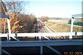
Living in HA7 1NN offers access to a range of amenities within walking or short driving distance. The area is served by five retail outlets, including Tesco Canons and Lidl Little, ensuring everyday shopping needs are met. Nearby metro stations like Canons Park and Queensbury provide easy access to parks and open spaces, while rail links to Harrow & Wealdstone and South Kenton connect residents to broader networks. The presence of five rail stations, including Mill Hill Broadway, underscores the area’s role as a commuter hub. For leisure, the proximity to Edgware and Canons Park offers recreational opportunities. The compact nature of HA7 1NN means residents can enjoy a mix of urban convenience and nearby green spaces, though the area’s small size means it is best suited for those prioritising accessibility over expansive living environments.
Amenities
Schools
| Rank | School | Type | Entry gender | Ages |
|---|
Explore more schools in this area
Go to Schools tabDemographics
The population of HA7 1NN is predominantly adults aged 30–64, with a median age of 47. This suggests a mature, stable community, likely composed of long-term residents and professionals. Home ownership here is relatively low, at 46%, indicating a higher proportion of renters compared to owner-occupied properties. The accommodation type is largely flats, which aligns with the area’s compact footprint and urban setting. The predominant ethnic group is Asian_total, highlighting the cultural diversity of the neighbourhood. This demographic profile suggests a community with established social networks and a focus on practical living. The absence of specific deprivation data means the area’s quality of life can be inferred from its amenities and safety metrics, which appear favourable. The mix of age groups and housing types creates a dynamic yet cohesive environment.
Household Size
Accommodation Type
Tenure
Ethnic Group
Religion
Household Composition
Age
Household Deprivation
NS-SEC
Explore more demographic insights in this area
Go to Demographics tabPlanning
Planning Constraints
- Flood RiskPremium
- Ramsar Wetland SitesPremium
- Area of Outstanding Natural BeautyPremium
- Protected Nature ReservePremium
- Protected WoodlandPremium