Area Overview for HA7 1NE
Photos of HA7 1NE
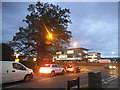

47 photos from this area
Area Information
Key information about the HA7 1NE including its size, population, and administrative classification.
- Area Type
- Postcode
- Area Size
- 7148 m²
- Population
- 1713
- Population Density
- 6457 people/km²
House Prices in HA7 1NE
21
Properties
£299,861
Average Sold Price
£85,000
Lowest Price
£550,000
Highest Price
Showing 21 properties
| Address | Type | Beds | Baths | Last Sale Price | Last Sale Date | |
|---|---|---|---|---|---|---|
| 21 Langland Crescent, Stanmore, HA7 1NE | Semi-detached | 3 | - | £550,000 | Jun 2017 | |
| 35 Langland Crescent, Stanmore, HA7 1NE | Semi-detached | 5 | - | £492,250 | Nov 2013 | |
| 11 Langland Crescent, Stanmore, HA7 1NE | house | - | - | £350,000 | Sep 2013 | |
| 25 Langland Crescent, Stanmore, HA7 1NE | Semi-detached | - | - | £403,000 | Aug 2010 | |
| 31 Langland Crescent, Stanmore, HA7 1NE | house | - | - | £262,500 | Jun 2006 | |
| 1 Langland Crescent, Stanmore, HA7 1NE | Retail | 2 | 2 | £240,000 | Sep 2001 | |
| 17 Langland Crescent, Stanmore, HA7 1NE | house | - | - | £181,000 | May 2000 | |
| 7 Langland Crescent, Stanmore, HA7 1NE | Retail | 2 | 2 | £135,000 | Oct 1999 | |
| 39 Langland Crescent, Stanmore, HA7 1NE | house | - | - | £85,000 | Aug 1995 | |
| 5 Langland Crescent, Stanmore, HA7 1NE | Retail | 2 | 2 | - | - |
Page 1 of 3
Energy Efficiency in HA7 1NE
Amenities
Schools
| Rank | School | Type | Entry gender | Ages |
|---|
Explore more schools in this area
Go to Schools tabDemographics
Household Size
Family (3-5 people)
most common
Accommodation Type
Houses
most common
Tenure
78
majority
Ethnic Group
asian_total
most common
Religion
N/A
most common
Household Composition
N/A
most common
Age
47
median
Adults (30-64 years)
most common
Household Deprivation
N/A
with no deprivation
NS-SEC
32
in Lower managerial occupations
Explore more demographic insights in this area
Go to Demographics tabPlanning
Planning Constraints
- Flood RiskPremium
- Ramsar Wetland SitesPremium
- Area of Outstanding Natural BeautyPremium
- Protected Nature ReservePremium
- Protected WoodlandPremium