Area Overview for HA7 1LU
Photos of HA7 1LU
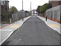
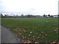
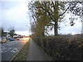
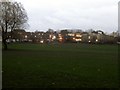
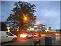
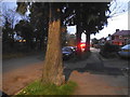

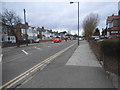
47 photos from this area
Area Information
Key information about the HA7 1LU including its size, population, and administrative classification.
- Area Type
- Postcode
- Area Size
- 1.1 hectares
- Population
- 1713
- Population Density
- 6457 people/km²
House Prices in HA7 1LU
20
Properties
£317,535
Average Sold Price
£90,000
Lowest Price
£648,000
Highest Price
Showing 20 properties
| Address | Type | Beds | Baths | Last Sale Price | Last Sale Date | |
|---|---|---|---|---|---|---|
| 186 Portland Crescent, Stanmore, HA7 1LU | Semi-detached | 4 | 3 | £648,000 | Mar 2021 | |
| 158 Portland Crescent, Stanmore, HA7 1LU | house | - | - | £600,000 | Dec 2015 | |
| 172 Portland Crescent, Stanmore, HA7 1LU | Semi-detached | 3 | - | £360,000 | Oct 2013 | |
| 174 Portland Crescent, Stanmore, HA7 1LU | house | 4 | 1 | £340,000 | Sep 2011 | |
| 184 Portland Crescent, Stanmore, HA7 1LU | house | 4 | - | £385,000 | Sep 2010 | |
| 176 Portland Crescent, Stanmore, HA7 1LU | house | 3 | 1 | £335,000 | Jan 2010 | |
| 156 Portland Crescent, Stanmore, HA7 1LU | Semi-detached | - | - | £300,000 | Aug 2009 | |
| 160 Portland Crescent, Stanmore, HA7 1LU | house | - | - | £325,000 | Nov 2007 | |
| 180 Portland Crescent, Stanmore, HA7 1LU | house | - | - | £249,995 | Aug 2005 | |
| 154 Portland Crescent, Stanmore, HA7 1LU | Semi-detached | - | - | £270,000 | Mar 2005 |
Page 1 of 2
Energy Efficiency in HA7 1LU
Amenities
Schools
| Rank | School | Type | Entry gender | Ages |
|---|
Explore more schools in this area
Go to Schools tabDemographics
Household Size
Family (3-5 people)
most common
Accommodation Type
Houses
most common
Tenure
78
majority
Ethnic Group
asian_total
most common
Religion
N/A
most common
Household Composition
N/A
most common
Age
47
median
Adults (30-64 years)
most common
Household Deprivation
N/A
with no deprivation
NS-SEC
32
in Lower managerial occupations
Explore more demographic insights in this area
Go to Demographics tabPlanning
Planning Constraints
- Flood RiskPremium
- Ramsar Wetland SitesPremium
- Area of Outstanding Natural BeautyPremium
- Protected Nature ReservePremium
- Protected WoodlandPremium