Area Overview for HA7 1BY
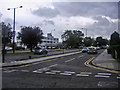
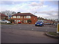
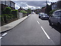
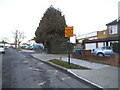
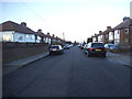
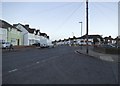
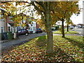
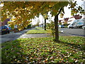
Photos of HA7 1BY


Area Information
HA7 1BY is a compact residential postcode in England, covering just 2,606 square metres and home to 1,811 residents. Its high population density of 694,980 people per square kilometre reflects a tightly knit community, where daily life is shaped by proximity to amenities and transport. The area is characterised by its mix of older housing stock and family homes, with a strong emphasis on home ownership. While small in size, HA7 1BY offers practical access to nearby retail, public transport, and green spaces, making it a viable option for those seeking a balance between urban convenience and residential tranquillity. The median age of 47 suggests a mature population, with a majority of residents aged between 30 and 64. This demographic, combined with the area’s low crime risk and flood safety, positions HA7 1BY as a stable, if modest, place to live. For buyers, the challenge lies in its limited size, which means properties are closely spaced and demand careful consideration of location within the postcode.
- Area Type
- Postcode
- Area Size
- 2606 m²
- Population
- 1811
- Population Density
- 6498 people/km²
The property market in HA7 1BY is dominated by owner-occupied homes, with 59% of residents owning their properties. The accommodation type is primarily houses, which are typically larger and more suited to families than flats. This suggests a housing stock that prioritises privacy and space over density, a characteristic that may appeal to buyers seeking traditional family homes. However, the small area size of 2,606 square metres means the market is limited, with properties closely clustered. Buyers should consider the proximity to amenities and transport when evaluating properties, as the area’s value is tied to its practical access to nearby services. The rental market, while present, is secondary to ownership, reflecting a community that leans towards long-term residency. For those seeking investment, the compact nature of HA7 1BY means competition for properties is likely to be high, particularly for homes near key transport hubs.
House Prices in HA7 1BY
No properties found in this postcode.
Energy Efficiency in HA7 1BY
Living in HA7 1BY offers a blend of practicality and accessibility. Within walking or short driving distance are five retail outlets, including Tesco Stanmore, Tesco Canons, and Tesco Edgware, ensuring everyday shopping needs are met. Metro stations like Canons Park and Queensbury provide easy access to local transport, while rail stations such as Harrow & Wealdstone and Mill Hill Broadway connect residents to broader regional networks. The area’s proximity to these hubs means residents can enjoy a mix of urban convenience and suburban calm. While specific parks or leisure facilities are not detailed in the data, the presence of multiple transport options and retail centres suggests a lifestyle focused on efficiency. The compact nature of the area means amenities are closely grouped, reducing the need for long commutes. For those who prioritise ease of access to services, HA7 1BY delivers a functional, if modest, living environment.
Amenities
Schools
| Rank | School | Type | Entry gender | Ages |
|---|
Explore more schools in this area
Go to Schools tabDemographics
The community in HA7 1BY is predominantly composed of adults aged 30–64, with a median age of 47. This suggests a population skewed towards middle-aged individuals, likely including families and professionals. Home ownership rates stand at 59%, indicating a mix of owner-occupied properties and rental homes. The accommodation type is primarily houses, reflecting a lack of high-density housing such as flats. The predominant ethnic group is Asian_total, which shapes the cultural fabric of the area. With a population density of 694,980 people per square kilometre, the area is highly compact, meaning residents live in close proximity to one another. This density does not necessarily correlate with deprivation, as the low crime risk score of 82 suggests a relatively safe environment. However, the lack of specific data on deprivation means the quality of life must be inferred from the available metrics, such as safety and connectivity.
Household Size
Accommodation Type
Tenure
Ethnic Group
Religion
Household Composition
Age
Household Deprivation
NS-SEC
Explore more demographic insights in this area
Go to Demographics tabPlanning
Planning Constraints
- Flood RiskPremium
- Ramsar Wetland SitesPremium
- Area of Outstanding Natural BeautyPremium
- Protected Nature ReservePremium
- Protected WoodlandPremium