Area Overview for HA6 3NS
Photos of HA6 3NS
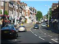
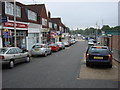
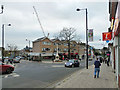
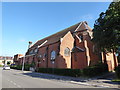
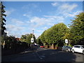
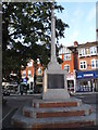
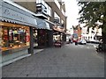
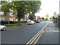
97 photos from this area
Area Information
Key information about the HA6 3NS including its size, population, and administrative classification.
- Area Type
- Postcode
- Area Size
- 2.6 hectares
- Population
- 1661
- Population Density
- 2591 people/km²
House Prices in HA6 3NS
41
Properties
£604,575
Average Sold Price
£158,000
Lowest Price
£1,175,000
Highest Price
Showing 41 properties
| Address | Type | Beds | Baths | Last Sale Price | Last Sale Date | |
|---|---|---|---|---|---|---|
| 7 Brookdene Drive, Northwood, HA6 3NS | house | 4 | 1 | £955,000 | Dec 2024 | |
| 27 Brookdene Drive, Northwood, HA6 3NS | house | - | - | £1,175,000 | Aug 2024 | |
| 10 Brookdene Drive, Northwood, HA6 3NS | Detached | 4 | 1 | £770,000 | Mar 2021 | |
| 26 Brookdene Drive, Northwood, HA6 3NS | Detached | 4 | 2 | £801,000 | Sep 2020 | |
| 19 Brookdene Drive, Northwood, HA6 3NS | Detached | 4 | 1 | £772,500 | Nov 2019 | |
| 16 Brookdene Drive, Northwood, HA6 3NS | house | - | - | £379,000 | Oct 2019 | |
| 28 Brookdene Drive, Northwood, HA6 3NS | Detached | 4 | 2 | £950,000 | Jul 2019 | |
| 15 Brookdene Drive, Northwood, HA6 3NS | house | 4 | 2 | £900,000 | Dec 2018 | |
| 12 Brookdene Drive, Northwood, HA6 3NS | Detached | 4 | 2 | £672,500 | Oct 2013 | |
| 29 Brookdene Drive, Northwood, HA6 3NS | house | 4 | - | £610,000 | Jul 2011 |
Page 1 of 5
Energy Efficiency in HA6 3NS
Amenities
Schools
| Rank | School | Type | Entry gender | Ages |
|---|
Explore more schools in this area
Go to Schools tabDemographics
Household Size
Family (3-5 people)
most common
Accommodation Type
Houses
most common
Tenure
86
majority
Ethnic Group
asian_total
most common
Religion
N/A
most common
Household Composition
N/A
most common
Age
47
median
Adults (30-64 years)
most common
Household Deprivation
N/A
with no deprivation
NS-SEC
55
in Lower managerial occupations
Explore more demographic insights in this area
Go to Demographics tabPlanning
Planning Constraints
- Flood RiskPremium
- Ramsar Wetland SitesPremium
- Area of Outstanding Natural BeautyPremium
- Protected Nature ReservePremium
- Protected WoodlandPremium