Area Overview for HA6 2AP
Photos of HA6 2AP
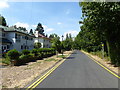
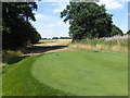
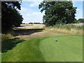
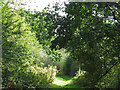
51 photos from this area
Area Information
Key information about the HA6 2AP including its size, population, and administrative classification.
- Area Type
- Postcode
- Area Size
- 3.3 hectares
- Population
- 1630
- Population Density
- 2624 people/km²
House Prices in HA6 2AP
32
Properties
£1,222,500
Average Sold Price
£450,000
Lowest Price
£1,962,500
Highest Price
Showing 32 properties
| Address | Type | Beds | Baths | Last Sale Price | Last Sale Date | |
|---|---|---|---|---|---|---|
| 25 Grove Road, Northwood, HA6 2AP | Detached | 4 | 2 | £1,625,000 | Mar 2025 | |
| 8 Grove Road, Northwood, HA6 2AP | Detached | 4 | - | £1,400,000 | Jul 2023 | |
| 9B Grove Road, Northwood, HA6 2AP | house | - | - | £1,650,000 | Jun 2023 | |
| 2 Grove Road, Northwood, HA6 2AP | Detached | 4 | 2 | £1,750,000 | Jun 2023 | |
| 17 Grove Road, Northwood, HA6 2AP | Retail | 4 | 1 | £1,600,000 | Jul 2022 | |
| 5 Grove Road, Northwood, HA6 2AP | house | 5 | 5 | £1,810,000 | Jul 2020 | |
| 1A Grove Road, Northwood, HA6 2AP | Bungalow | 5 | 5 | £1,962,500 | Dec 2019 | |
| 35 Grove Road, Northwood, HA6 2AP | Detached | 4 | 2 | £1,085,000 | Apr 2019 | |
| 27 Grove Road, Northwood, HA6 2AP | Detached | 3 | 2 | £930,000 | Jan 2014 | |
| 15 Grove Road, Northwood, HA6 2AP | Detached | 4 | 1 | £950,000 | Aug 2013 |
Page 1 of 4
Energy Efficiency in HA6 2AP
Amenities
Schools
| Rank | School | Type | Entry gender | Ages |
|---|
Explore more schools in this area
Go to Schools tabDemographics
Household Size
Family (3-5 people)
most common
Accommodation Type
Houses
most common
Tenure
77
majority
Ethnic Group
asian_total
most common
Religion
N/A
most common
Household Composition
N/A
most common
Age
47
median
Adults (30-64 years)
most common
Household Deprivation
N/A
with no deprivation
NS-SEC
56
in Lower managerial occupations
Explore more demographic insights in this area
Go to Demographics tabPlanning
Planning Constraints
- Flood RiskPremium
- Ramsar Wetland SitesPremium
- Area of Outstanding Natural BeautyPremium
- Protected Nature ReservePremium
- Protected WoodlandPremium