Area Overview for HA6 1EW
Photos of HA6 1EW
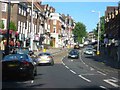
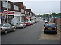
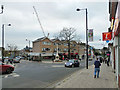
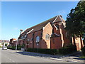
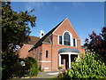
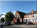
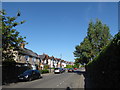
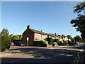
97 photos from this area
Area Information
Key information about the HA6 1EW including its size, population, and administrative classification.
- Area Type
- Postcode
- Area Size
- 9175 m²
- Population
- 1599
- Population Density
- 4377 people/km²
House Prices in HA6 1EW
42
Properties
£216,511
Average Sold Price
£82,500
Lowest Price
£510,550
Highest Price
Showing 42 properties
| Address | Type | Beds | Baths | Last Sale Price | Last Sale Date | |
|---|---|---|---|---|---|---|
| 74 Hawes Close, Northwood, HA6 1EW | Flat | - | - | £300,000 | Mar 2024 | |
| 81 Hawes Close, Northwood, HA6 1EW | Maisonette | 1 | 1 | £230,000 | Jun 2020 | |
| 20 Hawes Close, Northwood, HA6 1EW | Terraced | 2 | 1 | £392,500 | Mar 2019 | |
| 48 Hawes Close, Northwood, HA6 1EW | Terraced | 4 | 1 | £477,000 | Oct 2018 | |
| 46 Hawes Close, Northwood, HA6 1EW | Terraced | 3 | 2 | £510,550 | Jan 2017 | |
| 77 Hawes Close, Northwood, HA6 1EW | Maisonette | 1 | 1 | £267,300 | May 2016 | |
| 83 Hawes Close, Northwood, HA6 1EW | Maisonette | 1 | 1 | £255,000 | Mar 2016 | |
| 82 Hawes Close, Northwood, HA6 1EW | Maisonette | 1 | 1 | £196,000 | Jan 2015 | |
| 86 Hawes Close, Northwood, HA6 1EW | Maisonette | 1 | - | £151,000 | Feb 2014 | |
| 75 Hawes Close, Northwood, HA6 1EW | Maisonette | 1 | 1 | £182,000 | Jan 2014 |
Page 1 of 5
Energy Efficiency in HA6 1EW
Amenities
Schools
| Rank | School | Type | Entry gender | Ages |
|---|
Explore more schools in this area
Go to Schools tabDemographics
Household Size
Family (3-5 people)
most common
Accommodation Type
Houses
most common
Tenure
60
majority
Ethnic Group
White
most common
Religion
N/A
most common
Household Composition
N/A
most common
Age
47
median
Adults (30-64 years)
most common
Household Deprivation
N/A
with no deprivation
NS-SEC
49
in Lower managerial occupations
Explore more demographic insights in this area
Go to Demographics tabPlanning
Planning Constraints
- Flood RiskPremium
- Ramsar Wetland SitesPremium
- Area of Outstanding Natural BeautyPremium
- Protected Nature ReservePremium
- Protected WoodlandPremium