Area Overview for HA5 5QR
Photos of HA5 5QR
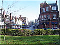
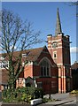
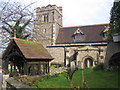
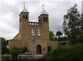
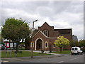

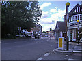
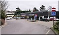
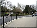
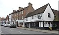

100 photos from this area
Area Information
Key information about the HA5 5QR including its size, population, and administrative classification.
- Area Type
- Postcode
- Area Size
- 6574 m²
- Population
- 1734
- Population Density
- 3901 people/km²
House Prices in HA5 5QR
21
Properties
£731,429
Average Sold Price
£230,000
Lowest Price
£1,400,000
Highest Price
Showing 21 properties
| Address | Type | Beds | Baths | Last Sale Price | Last Sale Date | |
|---|---|---|---|---|---|---|
| 17 Nower Hill, Pinner, HA5 5QR | Flat | - | - | £565,000 | Feb 2023 | |
| 31 Nower Hill, Pinner, HA5 5QR | Retail | 4 | 2 | £1,400,000 | Dec 2021 | |
| 19 Nower Hill, Pinner, HA5 5QR | house | - | - | £1,100,000 | Mar 2021 | |
| 17A Nower Hill, Pinner, HA5 5QR | Flat | - | - | £600,000 | Oct 2020 | |
| 11 Nower Hill, Pinner, HA5 5QR | Semi-detached | 4 | 2 | £975,000 | Jan 2017 | |
| 15 Nower Hill, Pinner, HA5 5QR | Maisonette | 3 | - | £250,000 | Aug 2010 | |
| 25 Nower Hill, Pinner, HA5 5QR | Terraced | - | - | £230,000 | Apr 1997 | |
| Flat 1, 9 Nower Hill, Pinner, HA5 5QR | Flat | 6 | - | - | - | |
| Flat 1, 11 Nower Hill, Pinner, HA5 5QR | Flat | - | - | - | - | |
| Flat 3, 9 Nower Hill, Pinner, HA5 5QR | Flat | - | - | - | - |
Page 1 of 3
Energy Efficiency in HA5 5QR
Amenities
Schools
| Rank | School | Type | Entry gender | Ages |
|---|
Explore more schools in this area
Go to Schools tabDemographics
Household Size
Family (3-5 people)
most common
Accommodation Type
Houses
most common
Tenure
66
majority
Ethnic Group
White
most common
Religion
N/A
most common
Household Composition
N/A
most common
Age
47
median
Adults (30-64 years)
most common
Household Deprivation
N/A
with no deprivation
NS-SEC
53
in Lower managerial occupations
Explore more demographic insights in this area
Go to Demographics tabPlanning
Planning Constraints
- Flood RiskPremium
- Ramsar Wetland SitesPremium
- Area of Outstanding Natural BeautyPremium
- Protected Nature ReservePremium
- Protected WoodlandPremium