Area Overview for HA5 5LQ
Photos of HA5 5LQ

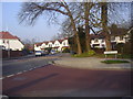
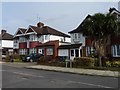
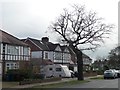
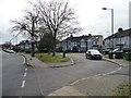
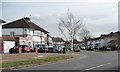
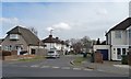
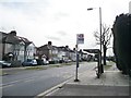


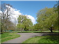
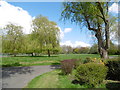
50 photos from this area
Area Information
Key information about the HA5 5LQ including its size, population, and administrative classification.
- Area Type
- Postcode
- Area Size
- 6606 m²
- Population
- 1658
- Population Density
- 5949 people/km²
House Prices in HA5 5LQ
19
Properties
£557,087
Average Sold Price
£165,000
Lowest Price
£942,500
Highest Price
Showing 19 properties
| Address | Type | Beds | Baths | Last Sale Price | Last Sale Date | |
|---|---|---|---|---|---|---|
| 37 Tewkesbury Avenue, Rayners Lane, HA5 5LQ | Semi-detached | 4 | 1 | £692,000 | Dec 2023 | |
| 3 Tewkesbury Avenue, Rayners Lane, HA5 5LQ | Semi-detached | 5 | 3 | £942,500 | Nov 2022 | |
| 21 Tewkesbury Avenue, Rayners Lane, HA5 5LQ | house | - | - | £759,000 | Mar 2022 | |
| 11 Tewkesbury Avenue, Rayners Lane, HA5 5LQ | Semi-detached | 4 | 2 | £695,000 | Mar 2021 | |
| 39 Tewkesbury Avenue, Rayners Lane, HA5 5LQ | Detached | 3 | 1 | £700,000 | Sep 2020 | |
| 31 Tewkesbury Avenue, Rayners Lane, HA5 5LQ | Semi-detached | 4 | 1 | £673,800 | Sep 2019 | |
| 19 Tewkesbury Avenue, Rayners Lane, HA5 5LQ | Semi-detached | 4 | 2 | £785,000 | Jun 2017 | |
| 1 Tewkesbury Avenue, Rayners Lane, HA5 5LQ | Semi-detached | 4 | 2 | £595,000 | Nov 2014 | |
| 23 Tewkesbury Avenue, Rayners Lane, HA5 5LQ | Semi-detached | 3 | - | £452,000 | Jul 2013 | |
| 25 Tewkesbury Avenue, Rayners Lane, HA5 5LQ | house | 4 | - | £460,000 | May 2010 |
Page 1 of 2
Energy Efficiency in HA5 5LQ
Amenities
Schools
| Rank | School | Type | Entry gender | Ages |
|---|
Explore more schools in this area
Go to Schools tabDemographics
Household Size
Family (3-5 people)
most common
Accommodation Type
Houses
most common
Tenure
79
majority
Ethnic Group
asian_total
most common
Religion
N/A
most common
Household Composition
N/A
most common
Age
47
median
Adults (30-64 years)
most common
Household Deprivation
N/A
with no deprivation
NS-SEC
46
in Lower managerial occupations
Explore more demographic insights in this area
Go to Demographics tabPlanning
Planning Constraints
- Flood RiskPremium
- Ramsar Wetland SitesPremium
- Area of Outstanding Natural BeautyPremium
- Protected Nature ReservePremium
- Protected WoodlandPremium