Area Overview for HA5 4SG
Photos of HA5 4SG
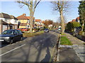
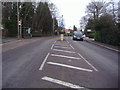
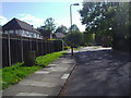
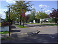

22 photos from this area
Area Information
Key information about the HA5 4SG including its size, population, and administrative classification.
- Area Type
- Postcode
- Area Size
- 6450 m²
- Population
- 1615
- Population Density
- 3482 people/km²
House Prices in HA5 4SG
8
Properties
£641,550
Average Sold Price
£350,000
Lowest Price
£888,400
Highest Price
Showing 8 properties
| Address | Type | Beds | Baths | Last Sale Price | Last Sale Date | |
|---|---|---|---|---|---|---|
| 518 Uxbridge Road, Hatch End, HA5 4SG | Semi-detached | 4 | 1 | £888,400 | Oct 2021 | |
| 516 Uxbridge Road, Hatch End, HA5 4SG | house | - | - | £732,000 | Nov 2016 | |
| 512 Uxbridge Road, Hatch End, HA5 4SG | Detached | 4 | 1 | £772,000 | Sep 2015 | |
| 510 Uxbridge Road, Hatch End, HA5 4SG | Detached | 4 | 1 | £850,000 | May 2015 | |
| 504 Uxbridge Road, Hatch End, HA5 4SG | Detached | 3 | - | £625,000 | Apr 2013 | |
| 514 Uxbridge Road, Hatch End, HA5 4SG | Detached | - | - | £495,000 | Mar 2005 | |
| 506 Uxbridge Road, Hatch End, HA5 4SG | Detached | 4 | 1 | £350,000 | Nov 2000 | |
| 508 Uxbridge Road, Hatch End, HA5 4SG | Detached | - | - | £420,000 | Sep 2000 |
Energy Efficiency in HA5 4SG
Amenities
Schools
| Rank | School | Type | Entry gender | Ages |
|---|
Explore more schools in this area
Go to Schools tabDemographics
Household Size
Family (3-5 people)
most common
Accommodation Type
Houses
most common
Tenure
80
majority
Ethnic Group
White
most common
Religion
N/A
most common
Household Composition
N/A
most common
Age
47
median
Adults (30-64 years)
most common
Household Deprivation
N/A
with no deprivation
NS-SEC
50
in Lower managerial occupations
Explore more demographic insights in this area
Go to Demographics tabPlanning
Planning Constraints
- Flood RiskPremium
- Ramsar Wetland SitesPremium
- Area of Outstanding Natural BeautyPremium
- Protected Nature ReservePremium
- Protected WoodlandPremium