Area Overview for HA5 4HD
Photos of HA5 4HD
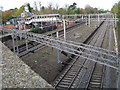


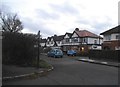

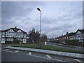
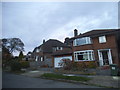

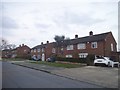


56 photos from this area
Area Information
Key information about the HA5 4HD including its size, population, and administrative classification.
- Area Type
- Postcode
- Area Size
- 1.6 hectares
- Population
- 1356
- Population Density
- 2167 people/km²
House Prices in HA5 4HD
23
Properties
£930,786
Average Sold Price
£380,000
Lowest Price
£1,450,000
Highest Price
Showing 23 properties
| Address | Type | Beds | Baths | Last Sale Price | Last Sale Date | |
|---|---|---|---|---|---|---|
| Haverley House, Royston Grove, Hatch End, HA5 4HD | Detached | 5 | 3 | £1,450,000 | Feb 2024 | |
| Marn House, Royston Grove, Hatch End, HA5 4HD | house | - | - | £1,400,000 | Jan 2021 | |
| Elmtree, Royston Grove, Hatch End, HA5 4HD | Detached | 5 | 2 | £1,215,000 | Oct 2020 | |
| Sans Souci, Royston Grove, Hatch End, HA5 4HD | Detached | 4 | 3 | £925,000 | Oct 2020 | |
| Dreamsville, Royston Grove, Hatch End, HA5 4HD | Flat | 3 | 2 | £950,000 | Sep 2020 | |
| Little Coach House, Royston Grove, Hatch End, HA5 4HD | Bungalow | - | - | £925,000 | Nov 2019 | |
| Ranmoor, Royston Grove, Hatch End, HA5 4HD | Detached | 4 | 2 | £1,325,000 | Jan 2017 | |
| Briarsdene, Royston Grove, Hatch End, HA5 4HD | house | - | - | £850,000 | Apr 2015 | |
| Oakhurst, Royston Grove, Hatch End, HA5 4HD | Detached | 4 | 1 | £1,015,000 | Oct 2014 | |
| Wootton, Royston Grove, Hatch End, HA5 4HD | house | 5 | - | £800,000 | Aug 2012 |
Page 1 of 3
Energy Efficiency in HA5 4HD
Amenities
Schools
| Rank | School | Type | Entry gender | Ages |
|---|
Explore more schools in this area
Go to Schools tabDemographics
Household Size
Family (3-5 people)
most common
Accommodation Type
Houses
most common
Tenure
83
majority
Ethnic Group
asian_total
most common
Religion
N/A
most common
Household Composition
N/A
most common
Age
47
median
Adults (30-64 years)
most common
Household Deprivation
N/A
with no deprivation
NS-SEC
48
in Lower managerial occupations
Explore more demographic insights in this area
Go to Demographics tabPlanning
Planning Constraints
- Flood RiskPremium
- Ramsar Wetland SitesPremium
- Area of Outstanding Natural BeautyPremium
- Protected Nature ReservePremium
- Protected WoodlandPremium