Area Overview for HA5 4EE
Photos of HA5 4EE


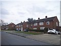
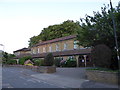
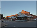
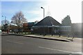
56 photos from this area
Area Information
Key information about the HA5 4EE including its size, population, and administrative classification.
- Area Type
- Postcode
- Area Size
- 3670 m²
- Population
- 2400
- Population Density
- 5782 people/km²
House Prices in HA5 4EE
32
Properties
£262,328
Average Sold Price
£65,000
Lowest Price
£459,500
Highest Price
Showing 32 properties
| Address | Type | Beds | Baths | Last Sale Price | Last Sale Date | |
|---|---|---|---|---|---|---|
| 114 Dove Park, Hatch End, HA5 4EE | Flat | 2 | 1 | £350,000 | Jul 2025 | |
| 93 Dove Park, Hatch End, HA5 4EE | Flat | - | - | £440,000 | Mar 2025 | |
| 100 Dove Park, Hatch End, HA5 4EE | Flat | 3 | 1 | £385,000 | Jul 2024 | |
| 95 Dove Park, Hatch End, HA5 4EE | Flat | 2 | 1 | £287,500 | Oct 2022 | |
| 112 Dove Park, Hatch End, HA5 4EE | Flat | - | - | £459,500 | Feb 2022 | |
| 96 Dove Park, Hatch End, HA5 4EE | Flat | - | - | £395,000 | Mar 2021 | |
| 118 Dove Park, Hatch End, HA5 4EE | Flat | 2 | 1 | £393,000 | Oct 2020 | |
| 117 Dove Park, Hatch End, HA5 4EE | Flat | 2 | - | £405,000 | Jun 2020 | |
| 109 Dove Park, Hatch End, HA5 4EE | Flat | 2 | 1 | £390,000 | Jun 2019 | |
| 116 Dove Park, Hatch End, HA5 4EE | Flat | - | - | £398,000 | Nov 2018 |
Page 1 of 4
Energy Efficiency in HA5 4EE
Amenities
Schools
| Rank | School | Type | Entry gender | Ages |
|---|
Explore more schools in this area
Go to Schools tabDemographics
Household Size
Family (3-5 people)
most common
Accommodation Type
Flats
most common
Tenure
50
majority
Ethnic Group
White
most common
Religion
N/A
most common
Household Composition
N/A
most common
Age
47
median
Adults (30-64 years)
most common
Household Deprivation
N/A
with no deprivation
NS-SEC
38
in Lower managerial occupations
Explore more demographic insights in this area
Go to Demographics tabPlanning
Planning Constraints
- Flood RiskPremium
- Ramsar Wetland SitesPremium
- Area of Outstanding Natural BeautyPremium
- Protected Nature ReservePremium
- Protected WoodlandPremium