Area Overview for HA5 3TY
Photos of HA5 3TY


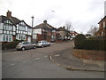
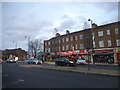
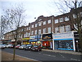
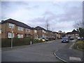
81 photos from this area
Area Information
Key information about the HA5 3TY including its size, population, and administrative classification.
- Area Type
- Postcode
- Area Size
- 9827 m²
- Population
- 1945
- Population Density
- 5349 people/km²
House Prices in HA5 3TY
32
Properties
£380,400
Average Sold Price
£90,500
Lowest Price
£785,000
Highest Price
Showing 32 properties
| Address | Type | Beds | Baths | Last Sale Price | Last Sale Date | |
|---|---|---|---|---|---|---|
| 94 Woodford Crescent, Northwood, HA5 3TY | Semi-detached | 3 | 1 | £624,000 | Mar 2025 | |
| 74 Woodford Crescent, Northwood, HA5 3TY | Maisonette | 2 | 1 | £410,000 | Jul 2024 | |
| 88 Woodford Crescent, Northwood, HA5 3TY | Semi-detached | 4 | 2 | £760,000 | Sep 2023 | |
| 82 Woodford Crescent, Northwood, HA5 3TY | Bungalow | 4 | 2 | £785,000 | May 2022 | |
| 102 Woodford Crescent, Northwood, HA5 3TY | Semi-detached | 2 | 1 | £485,000 | Mar 2020 | |
| 84 Woodford Crescent, Northwood, HA5 3TY | Semi-detached | 3 | 2 | £680,000 | Feb 2018 | |
| 76 Woodford Crescent, Northwood, HA5 3TY | Bungalow | 3 | - | £370,000 | Dec 2012 | |
| 108 Woodford Crescent, Northwood, HA5 3TY | Semi-detached | 3 | - | £355,000 | Feb 2012 | |
| 114 Woodford Crescent, Northwood, HA5 3TY | house | 6 | - | £475,000 | Dec 2010 | |
| 80 Woodford Crescent, Northwood, HA5 3TY | Semi-detached | - | - | £192,500 | Jul 2002 |
Page 1 of 4
Energy Efficiency in HA5 3TY
Amenities
Schools
| Rank | School | Type | Entry gender | Ages |
|---|
Explore more schools in this area
Go to Schools tabDemographics
Household Size
Family (3-5 people)
most common
Accommodation Type
Houses
most common
Tenure
59
majority
Ethnic Group
White
most common
Religion
N/A
most common
Household Composition
N/A
most common
Age
47
median
Adults (30-64 years)
most common
Household Deprivation
N/A
with no deprivation
NS-SEC
39
in Lower managerial occupations
Explore more demographic insights in this area
Go to Demographics tabPlanning
Planning Constraints
- Flood RiskPremium
- Ramsar Wetland SitesPremium
- Area of Outstanding Natural BeautyPremium
- Protected Nature ReservePremium
- Protected WoodlandPremium