Area Overview for HA5 2RS
Photos of HA5 2RS
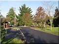

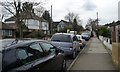
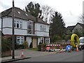
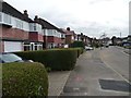
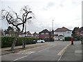
![Extended semi-detached houses on Rosecroft Walk [1] in HA5 2RS](https://images.propbar.co.uk/images/geograph/48/56/4856921_120.jpg)


29 photos from this area
Area Information
Key information about the HA5 2RS including its size, population, and administrative classification.
- Area Type
- Postcode
- Area Size
- 3548 m²
- Population
- 1418
- Population Density
- 3280 people/km²
House Prices in HA5 2RS
3
Properties
£697,500
Average Sold Price
£630,000
Lowest Price
£765,000
Highest Price
Showing 3 properties
| Address | Type | Beds | Baths | Last Sale Price | Last Sale Date | |
|---|---|---|---|---|---|---|
| 1 Rodney Gardens, Eastcote, HA5 2RS | Bungalow | 3 | 1 | £765,000 | May 2020 | |
| 3 Rodney Gardens, Eastcote, HA5 2RS | house | 3 | - | £630,000 | Oct 2012 | |
| 5 Rodney Gardens, Eastcote, HA5 2RS | Detached | - | - | - | - |
Energy Efficiency in HA5 2RS
Amenities
Schools
| Rank | School | Type | Entry gender | Ages |
|---|
Explore more schools in this area
Go to Schools tabDemographics
Household Size
Two person
most common
Accommodation Type
Houses
most common
Tenure
88
majority
Ethnic Group
White
most common
Religion
N/A
most common
Household Composition
N/A
most common
Age
47
median
Adults (30-64 years)
most common
Household Deprivation
N/A
with no deprivation
NS-SEC
51
in Lower managerial occupations
Explore more demographic insights in this area
Go to Demographics tabPlanning
Planning Constraints
- Flood RiskPremium
- Ramsar Wetland SitesPremium
- Area of Outstanding Natural BeautyPremium
- Protected Nature ReservePremium
- Protected WoodlandPremium