Area Overview for HA5 1TU
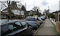
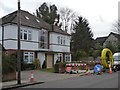
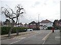
Photos of HA5 1TU
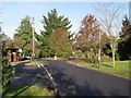

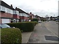
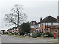
![Extended semi-detached houses on Rosecroft Walk [1] in HA5 1TU](https://images.propbar.co.uk/images/geograph/48/56/4856921_120.jpg)

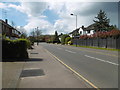

29 photos from this area
Area Information
Key information about the HA5 1TU including its size, population, and administrative classification.
- Area Type
- Postcode
- Area Size
- 2.1 hectares
- Population
- 1339
- Population Density
- 4774 people/km²
House Prices in HA5 1TU
31
Properties
£631,833
Average Sold Price
£215,000
Lowest Price
£1,000,000
Highest Price
Showing 31 properties
| Address | Type | Beds | Baths | Last Sale Price | Last Sale Date | |
|---|---|---|---|---|---|---|
| 28 Lowlands Road, Eastcote, HA5 1TU | Semi-detached | 4 | 2 | £910,000 | Jun 2025 | |
| 60 Lowlands Road, Eastcote, HA5 1TU | Semi-detached | 5 | 2 | £870,000 | May 2025 | |
| 44 Lowlands Road, Eastcote, HA5 1TU | house | - | - | £400,000 | Aug 2024 | |
| 58 Lowlands Road, Eastcote, HA5 1TU | Semi-detached | 3 | 1 | £760,000 | Jan 2024 | |
| 64 Lowlands Road, Eastcote, HA5 1TU | Semi-detached | 4 | 2 | £950,000 | Jul 2023 | |
| 62 Lowlands Road, Eastcote, HA5 1TU | Retail | 5 | 2 | £1,000,000 | Nov 2022 | |
| 36 Lowlands Road, Eastcote, HA5 1TU | house | - | - | £840,000 | Sep 2021 | |
| 48 Lowlands Road, Eastcote, HA5 1TU | house | - | - | £710,000 | Jun 2021 | |
| 74 Lowlands Road, Eastcote, HA5 1TU | Semi-detached | 3 | 1 | £745,000 | Nov 2018 | |
| 72 Lowlands Road, Eastcote, HA5 1TU | Semi-detached | 4 | 2 | £725,000 | Dec 2015 |
Page 1 of 4
Energy Efficiency in HA5 1TU
Amenities
Schools
| Rank | School | Type | Entry gender | Ages |
|---|
Explore more schools in this area
Go to Schools tabDemographics
Household Size
Family (3-5 people)
most common
Accommodation Type
Houses
most common
Tenure
91
majority
Ethnic Group
White
most common
Religion
N/A
most common
Household Composition
N/A
most common
Age
47
median
Adults (30-64 years)
most common
Household Deprivation
N/A
with no deprivation
NS-SEC
48
in Lower managerial occupations
Explore more demographic insights in this area
Go to Demographics tabPlanning
Planning Constraints
- Flood RiskPremium
- Ramsar Wetland SitesPremium
- Area of Outstanding Natural BeautyPremium
- Protected Nature ReservePremium
- Protected WoodlandPremium