Area Overview for HA4 9HU
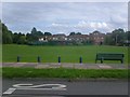
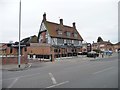
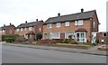
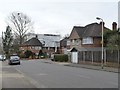
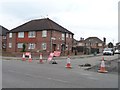
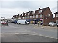
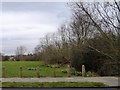
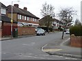
Photos of HA4 9HU


Area Information
HA4 9HU is a small residential postcode area in England, home to 1,744 residents. It is a compact cluster of properties, predominantly houses, reflecting a community rooted in stability and family living. The area’s population is largely composed of adults aged 30–64, with a median age of 47, suggesting a mature demographic that values established neighbourhoods. Daily life here is shaped by proximity to essential services and transport links. Residents benefit from nearby retail options, including major supermarkets like Morrisons Daily and Aldi South, as well as accessible rail and metro stations. The area’s low crime risk—scored 96/100—adds to its appeal as a safe, low-maintenance environment. While it lacks sprawling amenities, its practical layout and connectivity make it ideal for those prioritising convenience over urban vibrancy. For homebuyers, HA4 9HU offers a snapshot of traditional English suburbia, with a focus on comfort, security, and community.
- Area Type
- Postcode
- Area Size
- Not available
- Population
- 1744
- Population Density
- 8441 people/km²
HA4 9HU is primarily an owner-occupied area, with 82% of properties in private hands. This high level of home ownership suggests a stable market with limited rental activity, potentially making it less attractive to investors seeking turnover. The accommodation type is predominantly houses, which are typically larger and more suited to families or individuals requiring more space. Given the small size of the postcode area, the housing stock is likely limited, with properties concentrated in a compact cluster. For buyers, this means competition may be fierce, and the market could be more responsive to specific preferences, such as property size or layout. The absence of flats or apartments indicates a focus on traditional, family-friendly homes, which may appeal to those seeking a quieter, more established environment.
House Prices in HA4 9HU
No properties found in this postcode.
Energy Efficiency in HA4 9HU
HA4 9HU’s lifestyle is defined by accessibility to essential amenities within practical reach. Residents have access to five retail outlets, including major supermarkets like Morrisons Daily, Aldi South, and Asda South, ensuring convenience for shopping and daily needs. The area’s transport network, with rail, metro, and airport proximity, enhances its appeal for both commuters and frequent travellers. RAF Northolt provides a unique nearby facility, though its impact on daily life is minimal. The absence of major leisure or cultural hubs suggests a focus on practicality over entertainment, with the area catering to those prioritising ease of access to services over vibrant nightlife or recreational spaces. For residents, this means a straightforward, no-frills lifestyle with minimal effort required to meet daily needs.
Amenities
Schools
The nearest school to HA4 9HU is St Swithun Wells Catholic Primary School, a primary institution with a Good Ofsted rating. This provides families with access to a well-regarded early education option, though the data does not list secondary schools in the immediate area. The presence of a primary school with a positive rating is a key consideration for parents, ensuring quality education for younger children. However, families with older children may need to look further afield for secondary schooling. The school’s Catholic affiliation may also align with specific community values or preferences. Overall, the educational provision in HA4 9HU is focused on foundational learning, with the need for additional resources beyond primary level likely to be met through nearby towns.
| Rank | School | Type | Entry gender | Ages |
|---|
Explore more schools in this area
Go to Schools tabDemographics
HA4 9HU’s population is predominantly adults aged 30–64, with a median age of 47. This suggests a community of middle-aged residents, likely in their peak earning years, many of whom may be raising families or downsizing. Home ownership is high, at 82%, indicating a strong presence of long-term residents and a stable housing market. The area is characterised by houses rather than flats, reflecting a preference for larger, private properties. The predominant ethnic group is White, though no specific data on diversity or deprivation is provided. The high home ownership rate and mature age profile suggest a neighbourhood with low turnover, where residents may have established careers and local ties. This demographic profile aligns with a community that prioritises security and continuity over rapid change.
Household Size
Accommodation Type
Tenure
Ethnic Group
Religion
Household Composition
Age
Household Deprivation
NS-SEC
Explore more demographic insights in this area
Go to Demographics tabPlanning
Planning Constraints
- Flood RiskPremium
- Ramsar Wetland SitesPremium
- Area of Outstanding Natural BeautyPremium
- Protected Nature ReservePremium
- Protected WoodlandPremium