Area Overview for HA4 6JP
Photos of HA4 6JP
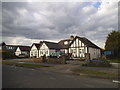
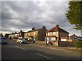
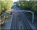
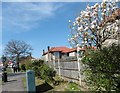
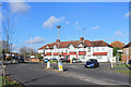
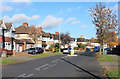
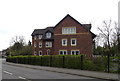
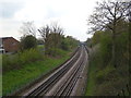
39 photos from this area
Area Information
Key information about the HA4 6JP including its size, population, and administrative classification.
- Area Type
- Postcode
- Area Size
- 5005 m²
- Population
- 1714
- Population Density
- 5771 people/km²
House Prices in HA4 6JP
20
Properties
£254,430
Average Sold Price
£125,950
Lowest Price
£355,000
Highest Price
Showing 20 properties
| Address | Type | Beds | Baths | Last Sale Price | Last Sale Date | |
|---|---|---|---|---|---|---|
| 25, Ruislip Court, Raleigh Close, Ruislip, HA4 6JP | Flat | 2 | 1 | £349,000 | Mar 2025 | |
| 28, Ruislip Court, Raleigh Close, Ruislip, HA4 6JP | Flat | - | - | £355,000 | Mar 2020 | |
| 35, Ruislip Court, Raleigh Close, Ruislip, HA4 6JP | Maisonette | 2 | 1 | £355,000 | Mar 2017 | |
| 33, Ruislip Court, Raleigh Close, Ruislip, HA4 6JP | Flat | - | - | £336,500 | Dec 2015 | |
| 29, Ruislip Court, Raleigh Close, Ruislip, HA4 6JP | Flat | 2 | 1 | £305,000 | May 2015 | |
| 37, Ruislip Court, Raleigh Close, Ruislip, HA4 6JP | Flat | - | - | £275,000 | Sep 2014 | |
| 32, Ruislip Court, Raleigh Close, Ruislip, HA4 6JP | Flat | - | - | £250,000 | May 2014 | |
| 23, Ruislip Court, Raleigh Close, Ruislip, HA4 6JP | Flat | - | - | £230,000 | May 2012 | |
| 27, Ruislip Court, Raleigh Close, Ruislip, HA4 6JP | Flat | - | - | £238,000 | Nov 2010 | |
| 22, Ruislip Court, Raleigh Close, Ruislip, HA4 6JP | Flat | - | - | £240,000 | Jul 2010 |
Page 1 of 2
Energy Efficiency in HA4 6JP
Amenities
Schools
| Rank | School | Type | Entry gender | Ages |
|---|
Explore more schools in this area
Go to Schools tabDemographics
Household Size
Family (3-5 people)
most common
Accommodation Type
Houses
most common
Tenure
63
majority
Ethnic Group
White
most common
Religion
N/A
most common
Household Composition
N/A
most common
Age
47
median
Adults (30-64 years)
most common
Household Deprivation
N/A
with no deprivation
NS-SEC
37
in Lower managerial occupations
Explore more demographic insights in this area
Go to Demographics tabPlanning
Planning Constraints
- Flood RiskPremium
- Ramsar Wetland SitesPremium
- Area of Outstanding Natural BeautyPremium
- Protected Nature ReservePremium
- Protected WoodlandPremium