Area Overview for HA4 0PN
Photos of HA4 0PN
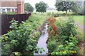
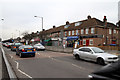
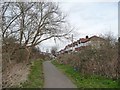
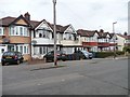
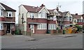
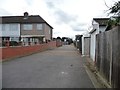
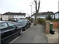
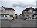
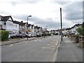
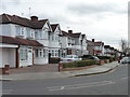
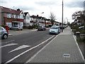
34 photos from this area
Area Information
Key information about the HA4 0PN including its size, population, and administrative classification.
- Area Type
- Postcode
- Area Size
- 9963 m²
- Population
- 1960
- Population Density
- 3337 people/km²
House Prices in HA4 0PN
35
Properties
£335,878
Average Sold Price
£95,000
Lowest Price
£560,000
Highest Price
Showing 35 properties
| Address | Type | Beds | Baths | Last Sale Price | Last Sale Date | |
|---|---|---|---|---|---|---|
| 177 Royal Crescent, Ruislip, HA4 0PN | house | 2 | 1 | £530,000 | Mar 2025 | |
| 171 Royal Crescent, Ruislip, HA4 0PN | Terraced | 2 | 1 | £430,000 | Apr 2022 | |
| 161 Royal Crescent, Ruislip, HA4 0PN | house | - | - | £490,000 | Feb 2022 | |
| 169 Royal Crescent, Ruislip, HA4 0PN | Terraced | 2 | 1 | £450,000 | Jun 2021 | |
| 179 Royal Crescent, Ruislip, HA4 0PN | house | - | - | £560,000 | Dec 2020 | |
| 159 Royal Crescent, Ruislip, HA4 0PN | Terraced | 2 | 1 | £385,000 | Oct 2020 | |
| 125 Royal Crescent, Ruislip, HA4 0PN | Terraced | 2 | 1 | £377,000 | Mar 2020 | |
| 121 Royal Crescent, Ruislip, HA4 0PN | Terraced | 2 | 1 | £395,000 | Jan 2020 | |
| 173 Royal Crescent, Ruislip, HA4 0PN | Terraced | 2 | - | £410,000 | Nov 2018 | |
| 149 Royal Crescent, Ruislip, HA4 0PN | Terraced | 2 | 2 | £450,000 | Oct 2018 |
Page 1 of 4
Energy Efficiency in HA4 0PN
Amenities
Schools
| Rank | School | Type | Entry gender | Ages |
|---|
Explore more schools in this area
Go to Schools tabDemographics
Household Size
Family (3-5 people)
most common
Accommodation Type
Houses
most common
Tenure
58
majority
Ethnic Group
White
most common
Religion
N/A
most common
Household Composition
N/A
most common
Age
47
median
Adults (30-64 years)
most common
Household Deprivation
N/A
with no deprivation
NS-SEC
35
in Lower managerial occupations
Explore more demographic insights in this area
Go to Demographics tabPlanning
Planning Constraints
- Flood RiskPremium
- Ramsar Wetland SitesPremium
- Area of Outstanding Natural BeautyPremium
- Protected Nature ReservePremium
- Protected WoodlandPremium