Area Overview for HA4 0LS
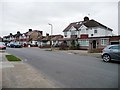
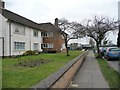
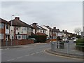
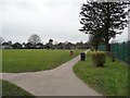
Photos of HA4 0LS
Area Information
Living in HA4 0LS means inhabiting a compact, densely populated postcode area of just 1.8 hectares, home to 1,414 residents. This small cluster of homes is defined by its high population density of 76,783 people per square kilometre, creating a tightly knit community. The area is predominantly residential, with 81% of properties owner-occupied and housing stock focused on traditional homes rather than flats. Daily life here is shaped by proximity to key amenities: nearby schools, rail and metro stations, and a local airport. The demographic profile is mature, with a median age of 47 and most residents aged between 30 and 64. This suggests a stable, established population, likely drawn to the area’s practical connectivity and proximity to transport links. While the small size of HA4 0LS may limit expansion, it ensures a sense of familiarity and accessibility for residents. The area’s compact nature also means that essential services are within walking or short driving distance, though flood risk remains a critical consideration for potential buyers.
- Area Type
- Postcode
- Area Size
- 1.8 hectares
- Population
- 1414
- Population Density
- 3572 people/km²
The property market in HA4 0LS is dominated by owner-occupied homes, with 81% of properties in private hands. This suggests a stable market with limited rental activity, appealing to buyers seeking long-term investment or family homes. The accommodation type is exclusively houses, which may reflect the area’s traditional character and the preferences of its mature demographic. Given the postcode’s small size of 1.8 hectares, the housing stock is likely limited, potentially increasing competition among buyers. The high home ownership rate also indicates that properties here are often held by residents for extended periods, which could influence market dynamics. For prospective buyers, this means a focus on established homes rather than new developments. The compact nature of HA4 0LS may also mean that property values are influenced by proximity to key amenities, such as schools and transport links, which are critical for families and commuters.
House Prices in HA4 0LS
No properties found in this postcode.
Energy Efficiency in HA4 0LS
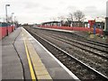
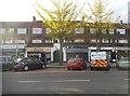
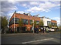
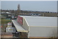
HA4 0LS offers a practical mix of retail, transport, and leisure options within easy reach. Local shops include major retailers such as Lidl South, Sainsburys South, and Tesco Ruislip Field, ensuring everyday shopping needs are met without long journeys. The area’s proximity to rail, metro, and the RAF Northolt airport enhances mobility, making it convenient for both daily commutes and travel. While green spaces are not explicitly mentioned in the data, the presence of transport hubs and retail centres suggests a focus on functionality over expansive parks. The compact nature of HA4 0LS means that amenities are closely clustered, reducing the need for cars and encouraging walking or cycling. This creates a lifestyle that balances accessibility with the constraints of a small postcode area, ideal for those prioritising convenience and connectivity over large-scale leisure facilities.
Amenities
Schools
HA4 0LS is served by three schools, each offering different educational options. Deanesfield Primary School, a primary school with a ‘good’ Ofsted rating, provides early education for younger children. Queensmead School, also a primary school, is listed but lacks an Ofsted rating in the data. A second Queensmead School, operating as an academy with a ‘good’ Ofsted rating, adds diversity to the local educational landscape. The presence of both a traditional primary school and an academy may offer families choices in teaching styles and curricula. However, the absence of a rating for one Queensmead School means potential buyers should verify current standards independently. For families prioritising school quality, the ‘good’ ratings at Deanesfield and the academy version of Queensmead suggest a generally reliable educational environment, though the small area’s limited school options may require careful consideration of commuting distances.
| Rank | School | Type | Entry gender | Ages |
|---|
Explore more schools in this area
Go to Schools tabDemographics
HA4 0LS has a median age of 47, with the majority of residents aged between 30 and 64. This indicates a mature, settled population, likely with strong ties to the local area. The high home ownership rate of 81% underscores a community of long-term residents rather than transient renters. Accommodation is predominantly houses, reflecting a preference for traditional housing over flats. The predominant ethnic group is White, which aligns with broader trends in the region. The population density of 76,783 people per square kilometre is exceptionally high, suggesting a compact, closely packed residential environment. This density may influence the character of the area, fostering a sense of community but also potentially limiting green space. The demographic data does not indicate significant deprivation, but the high population density could impact local infrastructure and amenities, necessitating efficient planning for services and transport.
Household Size
Accommodation Type
Tenure
Ethnic Group
Religion
Household Composition
Age
Household Deprivation
NS-SEC
Explore more demographic insights in this area
Go to Demographics tabPlanning
Planning Constraints
- Flood RiskPremium
- Ramsar Wetland SitesPremium
- Area of Outstanding Natural BeautyPremium
- Protected Nature ReservePremium
- Protected WoodlandPremium