Area Overview for HA4 0JW
Photos of HA4 0JW
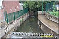
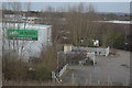
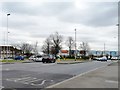
![Housing on the Brackenhill site [1] in HA4 0JW](https://images.propbar.co.uk/images/geograph/48/60/4860770_120.jpg)
53 photos from this area
Area Information
Key information about the HA4 0JW including its size, population, and administrative classification.
- Area Type
- Postcode
- Area Size
- 5954 m²
- Population
- 1960
- Population Density
- 3337 people/km²
House Prices in HA4 0JW
1
Properties
-
Average Sold Price
-
Lowest Price
-
Highest Price
Showing 1 properties
| Address | Type | Beds | Baths | Last Sale Price | Last Sale Date | |
|---|---|---|---|---|---|---|
| 2, Imperial Park Business Centre, Stonefield Way, Ruislip, HA4 0JW | Office | - | - | - | - |
Energy Efficiency in HA4 0JW
Amenities
Schools
| Rank | School | Type | Entry gender | Ages |
|---|
Explore more schools in this area
Go to Schools tabDemographics
Household Size
Family (3-5 people)
most common
Accommodation Type
Houses
most common
Tenure
58
majority
Ethnic Group
White
most common
Religion
N/A
most common
Household Composition
N/A
most common
Age
47
median
Adults (30-64 years)
most common
Household Deprivation
N/A
with no deprivation
NS-SEC
35
in Lower managerial occupations
Explore more demographic insights in this area
Go to Demographics tabPlanning
Planning Constraints
- Flood RiskPremium
- Ramsar Wetland SitesPremium
- Area of Outstanding Natural BeautyPremium
- Protected Nature ReservePremium
- Protected WoodlandPremium