Area Overview for HA4 0JR
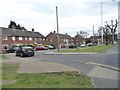
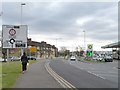
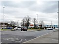
Photos of HA4 0JR
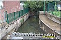

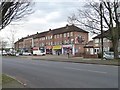

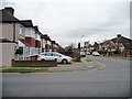
![Housing on the Brackenhill site [1] in HA4 0JR](https://images.propbar.co.uk/images/geograph/48/60/4860770_120.jpg)
Area Information
HA4 0JR is a small residential postcode in England, home to around 1960 people. It is a compact area with a focus on houses rather than flats, reflecting its suburban character. The community here is predominantly middle-aged, with a median age of 47 and most residents falling within the 30-64 age range. This suggests a stable population of working professionals and families. The area benefits from low flood risk and no proximity to protected natural sites, making it a practical choice for those seeking a balanced lifestyle. Nearby, residents have access to major retail chains like Lidl, Tesco, and Sainsburys, ensuring daily needs are met. Transport is well-served by multiple rail and metro stations, including South Ruislip, Northolt Park, and Northolt, linking the area to London’s transport network. With a broadband score of 99 and mobile coverage rated 85, connectivity is excellent, supporting both remote work and everyday internet use. HA4 0JR offers a blend of convenience, safety, and accessibility, ideal for those prioritising practicality without sacrificing comfort.
- Area Type
- Postcode
- Area Size
- Not available
- Population
- 1960
- Population Density
- 3337 people/km²
HA4 0JR is characterised by a high proportion of owner-occupied homes, with 58% of properties owned by residents. This suggests a stable market with fewer rental properties, likely attracting buyers seeking long-term investment or family homes. The area is dominated by houses rather than flats, reflecting a suburban, family-oriented layout. Given its small size, the immediate surroundings may offer more property options, though the local stock is limited. The predominance of houses means buyers should expect larger properties, potentially appealing to those prioritising space. However, the lack of specific data on property prices or development trends means the market’s dynamics remain opaque. For those considering HA4 0JR, the focus on owner-occupation and traditional housing stock indicates a community with strong ties to its residents.
House Prices in HA4 0JR
No properties found in this postcode.
Energy Efficiency in HA4 0JR
HA4 0JR offers a practical lifestyle with access to essential amenities. Retail options include major chains such as Lidl South, Tesco Ruislip Field, and Sainsburys South, ensuring daily shopping needs are met. The area’s transport links to rail and metro stations like Northolt and Ruislip Gardens make commuting efficient, connecting residents to nearby towns and London. While specific parks or leisure facilities are not detailed, the absence of protected natural areas suggests open spaces may be available for recreation. The presence of RAF Northolt nearby adds a distinct local character, though its impact on civilian life is minimal. Overall, HA4 0JR balances convenience with accessibility, providing a functional environment for daily living without sacrificing practicality.
Amenities
Schools
| Rank | School | Type | Entry gender | Ages |
|---|
Explore more schools in this area
Go to Schools tabDemographics
The population of HA4 0JR is 1960, with a median age of 47. Most residents are adults aged 30-64, indicating a mature, established community. Home ownership is high at 58%, suggesting a stable housing market with many long-term residents. The area is predominantly composed of houses, reflecting a traditional suburban layout. The predominant ethnic group is White, though specific data on diversity is not provided. The age profile and ownership figures suggest a community focused on family living and professional stability. With no data on deprivation, it is unclear how economic factors might influence quality of life, but the absence of protected natural areas and low flood risk implies minimal environmental constraints. The demographic profile aligns with a low-risk, low-volatility area, appealing to those seeking a settled environment.
Household Size
Accommodation Type
Tenure
Ethnic Group
Religion
Household Composition
Age
Household Deprivation
NS-SEC
Explore more demographic insights in this area
Go to Demographics tabPlanning
Planning Constraints
- Flood RiskPremium
- Ramsar Wetland SitesPremium
- Area of Outstanding Natural BeautyPremium
- Protected Nature ReservePremium
- Protected WoodlandPremium