Area Overview for HA4 0HE
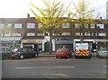
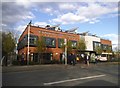
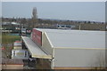
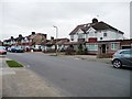
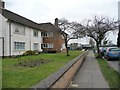
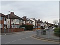
Photos of HA4 0HE

Area Information
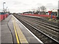
HA4 0HE is a small residential postcode in England, home to around 2,481 people. This compact area is characterised by its cluster of flats, catering to a community predominantly aged 30–64, with a median age of 47. The neighbourhood is positioned for practical living, with easy access to rail and metro stations, including South Ruislip, Northolt Park, and Ruislip Gardens. Nearby, the RAF Northolt airport adds a layer of connectivity for those requiring swift travel. Daily life here balances convenience with a quiet residential vibe, supported by five retail outlets such as Sainsburys South and Asda South. While the area lacks natural beauty designations, its proximity to transport hubs and essential services makes it appealing for commuters and families seeking a stable, low-flood-risk environment. However, residents should be mindful of the area’s high crime risk, which necessitates attention to security. For those prioritising accessibility and a straightforward lifestyle, HA4 0HE offers a pragmatic base in a well-connected part of the country.
- Area Type
- Postcode
- Area Size
- Not available
- Population
- 2481
- Population Density
- 3690 people/km²
The property market in HA4 0HE is defined by its high concentration of flats, with no indication of detached or semi-detached homes. Home ownership stands at 55%, suggesting that nearly half of properties are rented, likely to students, commuters, or those seeking short-term housing. This dynamic points to a rental market that may be more responsive to transient demand than long-term investment. The area’s small size and focus on flats imply limited scope for property expansion, which could make it a niche market for buyers seeking affordable, low-maintenance housing. However, the predominance of flats may also mean fewer opportunities for major renovations or customisation. For buyers, this area suits those prioritising convenience over space, particularly if proximity to rail networks and retail is a priority. The lack of data on property prices or recent sales trends means the market’s value proposition remains somewhat opaque, though its practicality for commuters is clear.
House Prices in HA4 0HE
No properties found in this postcode.
Energy Efficiency in HA4 0HE
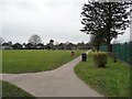
Living in HA4 0HE offers a blend of everyday convenience and accessibility. The area is served by five retail outlets, including Sainsburys South, Asda South, and Aldi South, ensuring residents have easy access to grocery shopping and daily essentials. Rail and metro stations such as South Ruislip, Northolt Park, and Ruislip Gardens provide frequent connections to London and nearby towns, reducing the need for private transport. The proximity to RAF Northolt adds a unique dimension, potentially appealing to those with military or aviation-related ties. While the area lacks major parks or leisure facilities, the surrounding transport links open up broader opportunities for recreation in nearby regions. The compact nature of HA4 0HE means amenities are within practical reach, fostering a lifestyle that prioritises efficiency. For those who value a straightforward, no-frills existence with reliable access to services, this area delivers.
Amenities
Schools
| Rank | School | Type | Entry gender | Ages |
|---|
Explore more schools in this area
Go to Schools tabDemographics
The community in HA4 0HE is predominantly composed of adults aged 30–64, with a median age of 47. This suggests a mature, established population, likely with long-term ties to the area. Home ownership sits at 55%, indicating a mix of owner-occupied and rental properties, though the accommodation type is overwhelmingly flats. The predominant ethnic group is White, reflecting a homogenous demographic profile. With no data on deprivation or diversity beyond these figures, the area appears to cater to a settled, middle-aged demographic. The lack of younger or older residents may influence local services and social dynamics, potentially shaping a community focused on stability over rapid change. This profile aligns with the practical, commuter-oriented nature of the area, where ease of transport and proximity to amenities seem to outweigh the absence of cultural or generational diversity.
Household Size
Accommodation Type
Tenure
Ethnic Group
Religion
Household Composition
Age
Household Deprivation
NS-SEC
Explore more demographic insights in this area
Go to Demographics tabPlanning
Planning Constraints
- Flood RiskPremium
- Ramsar Wetland SitesPremium
- Area of Outstanding Natural BeautyPremium
- Protected Nature ReservePremium
- Protected WoodlandPremium