Area Overview for HA3 8AJ
Photos of HA3 8AJ
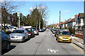
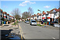
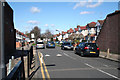
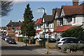
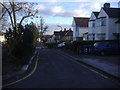
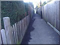
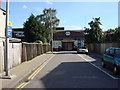
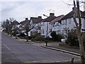

85 photos from this area
Area Information
Key information about the HA3 8AJ including its size, population, and administrative classification.
- Area Type
- Postcode
- Area Size
- 2.8 hectares
- Population
- 1840
- Population Density
- 6631 people/km²
House Prices in HA3 8AJ
35
Properties
£376,795
Average Sold Price
£110,000
Lowest Price
£930,000
Highest Price
Showing 35 properties
| Address | Type | Beds | Baths | Last Sale Price | Last Sale Date | |
|---|---|---|---|---|---|---|
| 23 Elmwood Avenue, Kenton, HA3 8AJ | Semi-detached | 4 | 2 | £670,000 | Feb 2025 | |
| 49 Elmwood Avenue, Kenton, HA3 8AJ | house | 3 | - | £630,000 | Aug 2023 | |
| 27 Elmwood Avenue, Kenton, HA3 8AJ | Flat | - | - | £450,000 | May 2021 | |
| 9A Elmwood Avenue, Kenton, HA3 8AJ | Detached | 6 | 3 | £930,000 | Apr 2021 | |
| 17 Elmwood Avenue, Kenton, HA3 8AJ | Semi-detached | 4 | 1 | £750,000 | Feb 2017 | |
| 29 Elmwood Avenue, Kenton, HA3 8AJ | Semi-detached | 4 | 1 | £580,000 | Feb 2015 | |
| 15 Elmwood Avenue, Kenton, HA3 8AJ | Semi-detached | 4 | 1 | £532,000 | Apr 2013 | |
| 57 Elmwood Avenue, Kenton, HA3 8AJ | house | 3 | - | £360,000 | Oct 2011 | |
| 39 Elmwood Avenue, Kenton, HA3 8AJ | house | - | - | £300,000 | Jul 2009 | |
| 37 Elmwood Avenue, Kenton, HA3 8AJ | Flat | 3 | 1 | £275,000 | Apr 2003 |
Page 1 of 4
Energy Efficiency in HA3 8AJ
Amenities
Schools
| Rank | School | Type | Entry gender | Ages |
|---|
Explore more schools in this area
Go to Schools tabDemographics
Household Size
Family (3-5 people)
most common
Accommodation Type
Houses
most common
Tenure
56
majority
Ethnic Group
asian_total
most common
Religion
N/A
most common
Household Composition
N/A
most common
Age
47
median
Adults (30-64 years)
most common
Household Deprivation
N/A
with no deprivation
NS-SEC
40
in Lower managerial occupations
Explore more demographic insights in this area
Go to Demographics tabPlanning
Planning Constraints
- Flood RiskPremium
- Ramsar Wetland SitesPremium
- Area of Outstanding Natural BeautyPremium
- Protected Nature ReservePremium
- Protected WoodlandPremium