Area Overview for HA3 7NU
Photos of HA3 7NU
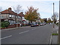
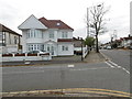
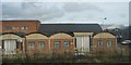
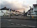
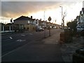
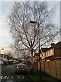


41 photos from this area
Area Information
Key information about the HA3 7NU including its size, population, and administrative classification.
- Area Type
- Postcode
- Area Size
- 4884 m²
- Population
- 1928
- Population Density
- 9256 people/km²
House Prices in HA3 7NU
15
Properties
£277,150
Average Sold Price
£84,000
Lowest Price
£635,000
Highest Price
Showing 15 properties
| Address | Type | Beds | Baths | Last Sale Price | Last Sale Date | |
|---|---|---|---|---|---|---|
| 41 Sancroft Road, Wealdstone, HA3 7NU | Terraced | 3 | 2 | £635,000 | Sep 2022 | |
| 35 Sancroft Road, Wealdstone, HA3 7NU | Terraced | 3 | - | £440,000 | Feb 2020 | |
| 47 Sancroft Road, Wealdstone, HA3 7NU | Terraced | - | - | £309,000 | Apr 2008 | |
| 57 Sancroft Road, Wealdstone, HA3 7NU | Terraced | - | - | £275,000 | Aug 2007 | |
| 43 Sancroft Road, Wealdstone, HA3 7NU | Terraced | - | - | £290,000 | May 2007 | |
| 59 Sancroft Road, Wealdstone, HA3 7NU | house | 3 | - | £248,000 | Feb 2005 | |
| 51 Sancroft Road, Wealdstone, HA3 7NU | house | - | - | £168,500 | Jun 2001 | |
| 53 Sancroft Road, Wealdstone, HA3 7NU | Terraced | - | - | £157,000 | Jun 2001 | |
| 33 Sancroft Road, Wealdstone, HA3 7NU | Semi-detached | 3 | 1 | £165,000 | Mar 2001 | |
| 55 Sancroft Road, Wealdstone, HA3 7NU | house | - | - | £84,000 | Jun 1996 |
Page 1 of 2
Energy Efficiency in HA3 7NU
Amenities
Schools
| Rank | School | Type | Entry gender | Ages |
|---|
Explore more schools in this area
Go to Schools tabDemographics
Household Size
Family (3-5 people)
most common
Accommodation Type
Houses
most common
Tenure
50
majority
Ethnic Group
White
most common
Religion
N/A
most common
Household Composition
N/A
most common
Age
47
median
Adults (30-64 years)
most common
Household Deprivation
N/A
with no deprivation
NS-SEC
24
in Lower managerial occupations
Explore more demographic insights in this area
Go to Demographics tabPlanning
Planning Constraints
- Flood RiskPremium
- Ramsar Wetland SitesPremium
- Area of Outstanding Natural BeautyPremium
- Protected Nature ReservePremium
- Protected WoodlandPremium