Area Overview for HA3 7HT
Photos of HA3 7HT
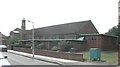
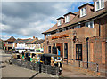
![SLMCC Hall, Whitefriars Avenue, Wealdstone [1] in HA3 7HT](https://images.propbar.co.uk/images/geograph/44/46/4446228_120.jpg)

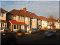
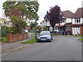
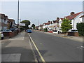

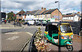
34 photos from this area
Area Information
Key information about the HA3 7HT including its size, population, and administrative classification.
- Area Type
- Postcode
- Area Size
- 1.2 hectares
- Population
- 2056
- Population Density
- 9576 people/km²
House Prices in HA3 7HT
33
Properties
£327,421
Average Sold Price
£68,000
Lowest Price
£625,000
Highest Price
Showing 33 properties
| Address | Type | Beds | Baths | Last Sale Price | Last Sale Date | |
|---|---|---|---|---|---|---|
| 58 Adderley Road, Harrow Weald, HA3 7HT | Detached | 3 | 1 | £585,000 | Sep 2025 | |
| 20 Adderley Road, Harrow Weald, HA3 7HT | house | - | - | £435,000 | Aug 2024 | |
| 26 Adderley Road, Harrow Weald, HA3 7HT | Retail | 3 | 2 | £585,000 | Mar 2023 | |
| 36 Adderley Road, Harrow Weald, HA3 7HT | Flat | 3 | 1 | £500,000 | Oct 2022 | |
| 60 Adderley Road, Harrow Weald, HA3 7HT | Terraced | 3 | 1 | £625,000 | Sep 2022 | |
| 52 Adderley Road, Harrow Weald, HA3 7HT | Terraced | 3 | 2 | £595,000 | Sep 2022 | |
| 22 Adderley Road, Harrow Weald, HA3 7HT | Terraced | 3 | 1 | £465,000 | Feb 2022 | |
| 64 Adderley Road, Harrow Weald, HA3 7HT | house | - | - | £250,000 | Feb 2021 | |
| 40 Adderley Road, Harrow Weald, HA3 7HT | Terraced | 3 | 1 | £430,000 | Apr 2019 | |
| 56 Adderley Road, Harrow Weald, HA3 7HT | Terraced | 3 | 1 | £480,000 | Jan 2019 |
Page 1 of 4
Energy Efficiency in HA3 7HT
Amenities
Schools
| Rank | School | Type | Entry gender | Ages |
|---|
Explore more schools in this area
Go to Schools tabDemographics
Household Size
Family (3-5 people)
most common
Accommodation Type
Houses
most common
Tenure
59
majority
Ethnic Group
asian_total
most common
Religion
N/A
most common
Household Composition
N/A
most common
Age
47
median
Adults (30-64 years)
most common
Household Deprivation
N/A
with no deprivation
NS-SEC
31
in Lower managerial occupations
Explore more demographic insights in this area
Go to Demographics tabPlanning
Planning Constraints
- Flood RiskPremium
- Ramsar Wetland SitesPremium
- Area of Outstanding Natural BeautyPremium
- Protected Nature ReservePremium
- Protected WoodlandPremium