Area Overview for HA3 7EW
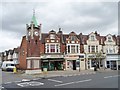
Photos of HA3 7EW
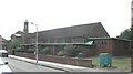
![SLMCC Hall, Whitefriars Avenue, Wealdstone [1] in HA3 7EW](https://images.propbar.co.uk/images/geograph/44/46/4446228_120.jpg)
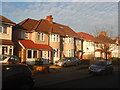
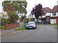
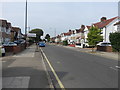
34 photos from this area
Area Information
Key information about the HA3 7EW including its size, population, and administrative classification.
- Area Type
- Postcode
- Area Size
- 7615 m²
- Population
- 1881
- Population Density
- 10937 people/km²
House Prices in HA3 7EW
16
Properties
£309,190
Average Sold Price
£64,000
Lowest Price
£530,000
Highest Price
Showing 16 properties
| Address | Type | Beds | Baths | Last Sale Price | Last Sale Date | |
|---|---|---|---|---|---|---|
| 15 The Greenway, Wealdstone, HA3 7EW | Terraced | 3 | 1 | £508,000 | Aug 2025 | |
| 31 The Greenway, Wealdstone, HA3 7EW | Terraced | 4 | 2 | £530,000 | Feb 2016 | |
| 29 The Greenway, Wealdstone, HA3 7EW | Terraced | 3 | 1 | £329,950 | Jul 2014 | |
| 3 The Greenway, Wealdstone, HA3 7EW | house | - | - | £114,000 | Oct 1999 | |
| 11 The Greenway, Wealdstone, HA3 7EW | Terraced | - | - | £64,000 | Oct 1995 | |
| 1 The Greenway, Wealdstone, HA3 7EW | Terraced | 3 | - | - | - | |
| 13 The Greenway, Wealdstone, HA3 7EW | Terraced | - | - | - | - | |
| 21 The Greenway, Wealdstone, HA3 7EW | Semi-detached | - | - | - | - | |
| 25 The Greenway, Wealdstone, HA3 7EW | Terraced | - | - | - | - | |
| 7 The Greenway, Wealdstone, HA3 7EW | house | - | - | - | - |
Page 1 of 2
Energy Efficiency in HA3 7EW
Amenities
Schools
| Rank | School | Type | Entry gender | Ages |
|---|
Explore more schools in this area
Go to Schools tabDemographics
Household Size
Family (3-5 people)
most common
Accommodation Type
Houses
most common
Tenure
41
majority
Ethnic Group
asian_total
most common
Religion
N/A
most common
Household Composition
N/A
most common
Age
47
median
Adults (30-64 years)
most common
Household Deprivation
N/A
with no deprivation
NS-SEC
21
in Lower managerial occupations
Explore more demographic insights in this area
Go to Demographics tabPlanning
Planning Constraints
- Flood RiskPremium
- Ramsar Wetland SitesPremium
- Area of Outstanding Natural BeautyPremium
- Protected Nature ReservePremium
- Protected WoodlandPremium