Area Overview for HA3 7BQ
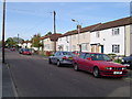
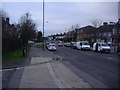
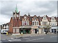
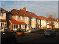
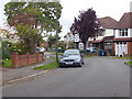
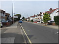
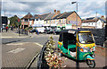
Photos of HA3 7BQ
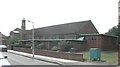
![SLMCC Hall, Whitefriars Avenue, Wealdstone [1] in HA3 7BQ](https://images.propbar.co.uk/images/geograph/44/46/4446228_120.jpg)


Area Information
HA3 7BQ is a small, tightly knit residential postcode in England, home to 2,056 people. The area is characterised by its compact size and focus on family-oriented living, with a median age of 47 and a population skewed towards adults aged 30–64. This suggests a stable, established community with a strong presence of homeowners, as 59% of properties are owner-occupied. The area is predominantly composed of houses, reflecting a quieter, more traditional residential environment. Residents benefit from proximity to key amenities, including five retail outlets such as Iceland Wealdstone and Asda Wealdstone, as well as multiple rail and metro stations. Digital connectivity is excellent, with a broadband score of 99 and mobile coverage rated 85, ensuring reliable internet for both work and leisure. Nearby schools like Belmont School and Belmont First School cater to primary education, while transport links to Harrow & Wealdstone Station and RAF Northolt provide access to London and beyond. The low crime score of 78 and minimal environmental risks make HA3 7BQ a practical, secure choice for those seeking a balanced lifestyle.
- Area Type
- Postcode
- Area Size
- Not available
- Population
- 2056
- Population Density
- 9576 people/km²
The property market in HA3 7BQ is dominated by owner-occupied homes, with 59% of properties owned by residents. The area’s housing stock is almost entirely composed of houses, which is unusual for a small postcode but suggests a focus on larger, family-friendly properties. This configuration may appeal to those seeking spacious, established homes rather than apartments or flats. The compact size of the area means the housing market is limited, with buyers likely needing to consider nearby zones for additional options. The high home ownership rate indicates a stable market with fewer rental properties, which could influence availability for renters. For buyers, the presence of houses may mean higher property values, but the area’s proximity to transport links and amenities could justify the investment. The lack of planning constraints or environmental restrictions also makes it a viable option for long-term ownership.
House Prices in HA3 7BQ
No properties found in this postcode.
Energy Efficiency in HA3 7BQ
Residents of HA3 7BQ enjoy a range of amenities within practical reach. The area is served by five retail outlets, including Iceland Wealdstone, Asda Wealdstone, and Waitrose Harrow, offering a mix of supermarket and specialty shopping. Transport links are extensive, with five rail stations and five metro stops providing easy access to London and surrounding areas. The nearby RAF Northolt airport adds to the area’s connectivity. While the data does not specify parks or leisure facilities, the absence of environmental constraints like protected woodlands or AONB designations suggests open spaces may be accessible nearby. The combination of retail, transport, and digital connectivity creates a convenient lifestyle, ideal for those prioritising accessibility and practicality. The area’s compact size means amenities are closely clustered, reducing the need for long commutes.
Amenities
Schools
Residents of HA3 7BQ have access to two primary schools: Belmont School and Belmont First School. Both institutions are rated as good by Ofsted, with the former providing a broader primary education and the latter likely focusing on younger children. The presence of two primary schools within the area suggests a family-friendly environment, catering to children from early years through to primary age. However, the data does not mention secondary schools, meaning parents may need to consider commuting to nearby areas for secondary education. The schools’ proximity to homes reduces travel time, which is a key consideration for families. The good Ofsted ratings indicate reliable educational standards, though parents should verify current performance metrics. Overall, the availability of primary schools reinforces HA3 7BQ’s appeal to households with children.
| Rank | School | Type | Entry gender | Ages |
|---|
Explore more schools in this area
Go to Schools tabDemographics
The population of HA3 7BQ is 2,056, with a median age of 47, indicating a mature demographic profile. The most common age range is 30–64 years, suggesting a community of established professionals and families. Home ownership is strong, with 59% of residents owning their homes, while the remaining 41% likely rent. The area is predominantly composed of houses, which aligns with the age profile and implies a preference for larger, more permanent living spaces. The predominant ethnic group is Asian, reflecting a culturally diverse but cohesive community. This diversity is likely supported by the area’s proximity to retail and transport hubs. The absence of specific deprivation data means the quality of life remains unquantified, but the low crime rate and access to amenities suggest a stable environment. The demographic mix, combined with a focus on homeownership, indicates a community prioritising long-term residency and family-oriented living.
Household Size
Accommodation Type
Tenure
Ethnic Group
Religion
Household Composition
Age
Household Deprivation
NS-SEC
Explore more demographic insights in this area
Go to Demographics tabPlanning
Planning Constraints
- Flood RiskPremium
- Ramsar Wetland SitesPremium
- Area of Outstanding Natural BeautyPremium
- Protected Nature ReservePremium
- Protected WoodlandPremium