Area Overview for HA3 0XY
Photos of HA3 0XY
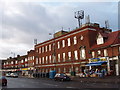
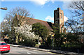
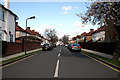
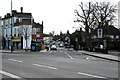
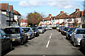
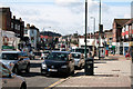
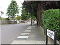
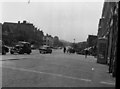

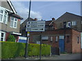
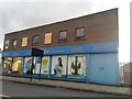
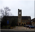
58 photos from this area
Area Information
Key information about the HA3 0XY including its size, population, and administrative classification.
- Area Type
- Postcode
- Area Size
- 3616 m²
- Population
- 1411
- Population Density
- 5814 people/km²
House Prices in HA3 0XY
21
Properties
£226,571
Average Sold Price
£20,000
Lowest Price
£360,000
Highest Price
Showing 21 properties
| Address | Type | Beds | Baths | Last Sale Price | Last Sale Date | |
|---|---|---|---|---|---|---|
| 447B Kenton Road, Harrow, HA3 0XY | Flat | - | - | £233,000 | Mar 2025 | |
| 433A Kenton Road, Harrow, HA3 0XY | Flat | 4 | 1 | £20,000 | Aug 2024 | |
| 445A Kenton Road, Harrow, HA3 0XY | Flat | - | - | £250,000 | Feb 2017 | |
| 439A Kenton Road, Harrow, HA3 0XY | Flat | - | - | £249,000 | Nov 2005 | |
| 441A Kenton Road, Harrow, HA3 0XY | Flat | - | - | £249,000 | Oct 2005 | |
| 435A Kenton Road, Harrow, HA3 0XY | Flat | 4 | 1 | £360,000 | Sep 2003 | |
| 437A Kenton Road, Harrow, HA3 0XY | Flat | - | - | £225,000 | Jul 2003 | |
| 447E Kenton Road, Harrow, HA3 0XY | Flat | 2 | 1 | - | - | |
| 447D Kenton Road, Harrow, HA3 0XY | Flat | 1 | 1 | - | - | |
| 447C Kenton Road, Harrow, HA3 0XY | Flat | 1 | 1 | - | - |
Page 1 of 3
Energy Efficiency in HA3 0XY
Amenities
Schools
| Rank | School | Type | Entry gender | Ages |
|---|
Explore more schools in this area
Go to Schools tabDemographics
Household Size
Family (3-5 people)
most common
Accommodation Type
Houses
most common
Tenure
51
majority
Ethnic Group
asian_total
most common
Religion
N/A
most common
Household Composition
N/A
most common
Age
47
median
Adults (30-64 years)
most common
Household Deprivation
N/A
with no deprivation
NS-SEC
27
in Lower managerial occupations
Explore more demographic insights in this area
Go to Demographics tabPlanning
Planning Constraints
- Flood RiskPremium
- Ramsar Wetland SitesPremium
- Area of Outstanding Natural BeautyPremium
- Protected Nature ReservePremium
- Protected WoodlandPremium