Area Overview for HA3 0XG
Photos of HA3 0XG
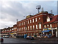
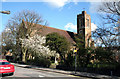
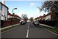
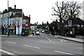
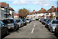
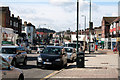
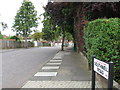
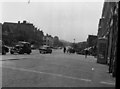


58 photos from this area
Area Information
Key information about the HA3 0XG including its size, population, and administrative classification.
- Area Type
- Postcode
- Area Size
- 2.7 hectares
- Population
- 1411
- Population Density
- 5814 people/km²
House Prices in HA3 0XG
32
Properties
£311,502
Average Sold Price
£74,000
Lowest Price
£730,000
Highest Price
Showing 32 properties
| Address | Type | Beds | Baths | Last Sale Price | Last Sale Date | |
|---|---|---|---|---|---|---|
| 33 Woodgrange Avenue, Harrow, HA3 0XG | Flat | 2 | - | £280,000 | Sep 2022 | |
| 37 Woodgrange Avenue, Harrow, HA3 0XG | Flat | 2 | 1 | £380,000 | Sep 2022 | |
| 35 Woodgrange Avenue, Harrow, HA3 0XG | Maisonette | 2 | - | £325,000 | Jun 2022 | |
| 63 Woodgrange Avenue, Harrow, HA3 0XG | Semi-detached | 4 | 2 | £730,000 | Feb 2021 | |
| 65 Woodgrange Avenue, Harrow, HA3 0XG | Semi-detached | 4 | 1 | £570,000 | Feb 2016 | |
| 69 Woodgrange Avenue, Harrow, HA3 0XG | Maisonette | - | - | £280,000 | Dec 2014 | |
| 71A Woodgrange Avenue, Harrow, HA3 0XG | Maisonette | 4 | 2 | £203,004 | Jun 2013 | |
| 45 Woodgrange Avenue, Harrow, HA3 0XG | house | 3 | - | £385,000 | Oct 2012 | |
| 51 Woodgrange Avenue, Harrow, HA3 0XG | house | - | - | £500,000 | Sep 2009 | |
| 47 Woodgrange Avenue, Harrow, HA3 0XG | Flat | - | - | £355,000 | Aug 2007 |
Page 1 of 4
Energy Efficiency in HA3 0XG
Amenities
Schools
| Rank | School | Type | Entry gender | Ages |
|---|
Explore more schools in this area
Go to Schools tabDemographics
Household Size
Family (3-5 people)
most common
Accommodation Type
Houses
most common
Tenure
51
majority
Ethnic Group
asian_total
most common
Religion
N/A
most common
Household Composition
N/A
most common
Age
47
median
Adults (30-64 years)
most common
Household Deprivation
N/A
with no deprivation
NS-SEC
27
in Lower managerial occupations
Explore more demographic insights in this area
Go to Demographics tabPlanning
Planning Constraints
- Flood RiskPremium
- Ramsar Wetland SitesPremium
- Area of Outstanding Natural BeautyPremium
- Protected Nature ReservePremium
- Protected WoodlandPremium