Area Overview for HA3 0LS
Photos of HA3 0LS
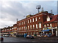
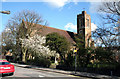
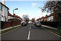
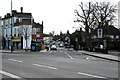
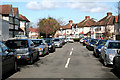
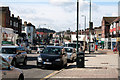
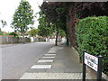
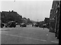


58 photos from this area
Area Information
Key information about the HA3 0LS including its size, population, and administrative classification.
- Area Type
- Postcode
- Area Size
- 1.1 hectares
- Population
- 1622
- Population Density
- 4069 people/km²
House Prices in HA3 0LS
22
Properties
£477,500
Average Sold Price
£165,000
Lowest Price
£950,000
Highest Price
Showing 22 properties
| Address | Type | Beds | Baths | Last Sale Price | Last Sale Date | |
|---|---|---|---|---|---|---|
| 47 Ebrington Road, Harrow, HA3 0LS | Semi-detached | 5 | 3 | £950,000 | Mar 2025 | |
| 31 Ebrington Road, Harrow, HA3 0LS | Semi-detached | 5 | 3 | £900,000 | Aug 2023 | |
| 15 Ebrington Road, Harrow, HA3 0LS | Semi-detached | 3 | 1 | £525,000 | Mar 2014 | |
| 27 Ebrington Road, Harrow, HA3 0LS | Semi-detached | - | - | £620,000 | Oct 2007 | |
| 33 Ebrington Road, Harrow, HA3 0LS | Semi-detached | - | - | £435,000 | Aug 2007 | |
| 39 Ebrington Road, Harrow, HA3 0LS | Semi-detached | - | - | £575,000 | Apr 2007 | |
| 25 Ebrington Road, Harrow, HA3 0LS | Detached | - | - | £615,000 | Jan 2006 | |
| 35 Ebrington Road, Harrow, HA3 0LS | Terraced | - | - | £365,000 | Aug 2004 | |
| 11 Ebrington Road, Harrow, HA3 0LS | Semi-detached | - | - | £330,000 | Nov 2003 | |
| 29 Ebrington Road, Harrow, HA3 0LS | house | 6 | - | £335,000 | Nov 2001 |
Page 1 of 3
Energy Efficiency in HA3 0LS
Amenities
Schools
| Rank | School | Type | Entry gender | Ages |
|---|
Explore more schools in this area
Go to Schools tabDemographics
Household Size
Family (3-5 people)
most common
Accommodation Type
Houses
most common
Tenure
83
majority
Ethnic Group
asian_total
most common
Religion
N/A
most common
Household Composition
N/A
most common
Age
47
median
Adults (30-64 years)
most common
Household Deprivation
N/A
with no deprivation
NS-SEC
42
in Lower managerial occupations
Explore more demographic insights in this area
Go to Demographics tabPlanning
Planning Constraints
- Flood RiskPremium
- Ramsar Wetland SitesPremium
- Area of Outstanding Natural BeautyPremium
- Protected Nature ReservePremium
- Protected WoodlandPremium