Area Overview for HA3 0JF
Photos of HA3 0JF
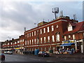
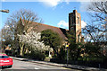
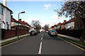
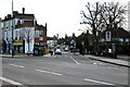
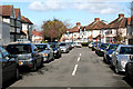
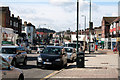
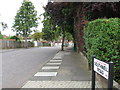
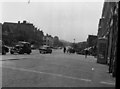

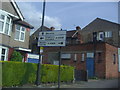

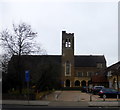
58 photos from this area
Area Information
Key information about the HA3 0JF including its size, population, and administrative classification.
- Area Type
- Postcode
- Area Size
- 6918 m²
- Population
- 1562
- Population Density
- 4672 people/km²
House Prices in HA3 0JF
12
Properties
£498,875
Average Sold Price
£172,000
Lowest Price
£840,000
Highest Price
Showing 12 properties
| Address | Type | Beds | Baths | Last Sale Price | Last Sale Date | |
|---|---|---|---|---|---|---|
| 54 Woodcock Hill, Harrow, HA3 0JF | Retail | 4 | 2 | £840,000 | Dec 2021 | |
| 62 Woodcock Hill, Harrow, HA3 0JF | house | - | - | £750,000 | Sep 2020 | |
| 58 Woodcock Hill, Harrow, HA3 0JF | house | - | - | £686,000 | Aug 2016 | |
| 44 Woodcock Hill, Harrow, HA3 0JF | house | - | - | £455,000 | Aug 2009 | |
| 52 Woodcock Hill, Harrow, HA3 0JF | Detached | - | - | £438,000 | Jun 2005 | |
| 66 Woodcock Hill, Harrow, HA3 0JF | Detached | - | - | £400,000 | May 2002 | |
| 50 Woodcock Hill, Harrow, HA3 0JF | Semi-detached | - | - | £250,000 | Sep 2000 | |
| 48 Woodcock Hill, Harrow, HA3 0JF | Semi-detached | - | - | £172,000 | Apr 1998 | |
| 46 Woodcock Hill, Harrow, HA3 0JF | Semi-detached | 5 | 1 | - | - | |
| 64 Woodcock Hill, Harrow, HA3 0JF | Semi-detached | - | - | - | - |
Page 1 of 2
Energy Efficiency in HA3 0JF
Amenities
Schools
| Rank | School | Type | Entry gender | Ages |
|---|
Explore more schools in this area
Go to Schools tabDemographics
Household Size
Family (3-5 people)
most common
Accommodation Type
Houses
most common
Tenure
73
majority
Ethnic Group
asian_total
most common
Religion
N/A
most common
Household Composition
N/A
most common
Age
47
median
Adults (30-64 years)
most common
Household Deprivation
N/A
with no deprivation
NS-SEC
40
in Lower managerial occupations
Explore more demographic insights in this area
Go to Demographics tabPlanning
Planning Constraints
- Flood RiskPremium
- Ramsar Wetland SitesPremium
- Area of Outstanding Natural BeautyPremium
- Protected Nature ReservePremium
- Protected WoodlandPremium