Area Overview for HA3 0EG
Photos of HA3 0EG
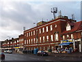
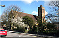
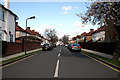
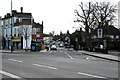
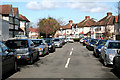
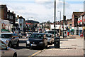
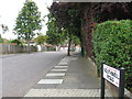
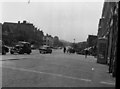


58 photos from this area
Area Information
Key information about the HA3 0EG including its size, population, and administrative classification.
- Area Type
- Postcode
- Area Size
- 1.3 hectares
- Population
- 1456
- Population Density
- 3878 people/km²
House Prices in HA3 0EG
20
Properties
£543,125
Average Sold Price
£130,000
Lowest Price
£1,035,000
Highest Price
Showing 20 properties
| Address | Type | Beds | Baths | Last Sale Price | Last Sale Date | |
|---|---|---|---|---|---|---|
| 24 Greystone Gardens, Harrow, HA3 0EG | house | - | - | £660,000 | Nov 2023 | |
| 32 Greystone Gardens, Harrow, HA3 0EG | Retail | 4 | 2 | £1,035,000 | Sep 2021 | |
| 8 Greystone Gardens, Harrow, HA3 0EG | house | 1 | - | £930,000 | May 2017 | |
| 18 Greystone Gardens, Harrow, HA3 0EG | Detached | 3 | 1 | £488,000 | Jun 2013 | |
| 34 Greystone Gardens, Harrow, HA3 0EG | Semi-detached | 5 | 2 | £450,000 | Oct 2012 | |
| 12 Greystone Gardens, Harrow, HA3 0EG | Semi-detached | 3 | - | £420,500 | Sep 2008 | |
| 20 Greystone Gardens, Harrow, HA3 0EG | Detached | - | - | £769,000 | Jan 2008 | |
| 6 Greystone Gardens, Harrow, HA3 0EG | Semi-detached | - | - | £645,000 | Sep 2007 | |
| 40 Greystone Gardens, Harrow, HA3 0EG | Semi-detached | 3 | - | £405,000 | Dec 2006 | |
| 2 Greystone Gardens, Harrow, HA3 0EG | Detached | - | - | £425,000 | Jan 2001 |
Page 1 of 2
Energy Efficiency in HA3 0EG
Amenities
Schools
| Rank | School | Type | Entry gender | Ages |
|---|
Explore more schools in this area
Go to Schools tabDemographics
Household Size
Family (3-5 people)
most common
Accommodation Type
Houses
most common
Tenure
79
majority
Ethnic Group
asian_total
most common
Religion
N/A
most common
Household Composition
N/A
most common
Age
47
median
Adults (30-64 years)
most common
Household Deprivation
N/A
with no deprivation
NS-SEC
44
in Lower managerial occupations
Explore more demographic insights in this area
Go to Demographics tabPlanning
Planning Constraints
- Flood RiskPremium
- Ramsar Wetland SitesPremium
- Area of Outstanding Natural BeautyPremium
- Protected Nature ReservePremium
- Protected WoodlandPremium