Area Overview for HA3 0DB
Photos of HA3 0DB
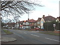
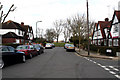
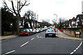
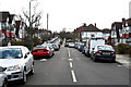
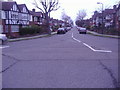
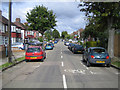
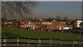
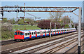


100 photos from this area
Area Information
Key information about the HA3 0DB including its size, population, and administrative classification.
- Area Type
- Postcode
- Area Size
- 2.1 hectares
- Population
- 1456
- Population Density
- 3878 people/km²
House Prices in HA3 0DB
30
Properties
£463,682
Average Sold Price
£110,000
Lowest Price
£990,000
Highest Price
Showing 30 properties
| Address | Type | Beds | Baths | Last Sale Price | Last Sale Date | |
|---|---|---|---|---|---|---|
| 30 Aston Avenue, Harrow, HA3 0DB | house | - | - | £990,000 | Nov 2024 | |
| 4 Aston Avenue, Harrow, HA3 0DB | house | 4 | - | £900,000 | Jan 2023 | |
| 28 Aston Avenue, Harrow, HA3 0DB | Retail | 5 | 2 | £915,000 | Jun 2022 | |
| 25 Aston Avenue, Harrow, HA3 0DB | Detached | 3 | - | £650,000 | May 2020 | |
| 7 Aston Avenue, Harrow, HA3 0DB | Detached | 4 | 1 | £800,000 | Aug 2017 | |
| 1 Aston Avenue, Harrow, HA3 0DB | Semi-detached | 3 | - | £660,000 | Mar 2017 | |
| 21 Aston Avenue, Harrow, HA3 0DB | house | 1 | 1 | £436,000 | Sep 2010 | |
| 9 Aston Avenue, Harrow, HA3 0DB | Detached | - | - | £685,000 | Nov 2007 | |
| 24 Aston Avenue, Harrow, HA3 0DB | Semi-detached | - | - | £552,000 | Feb 2007 | |
| 12 Aston Avenue, Harrow, HA3 0DB | Semi-detached | - | - | £370,000 | May 2006 |
Page 1 of 3
Energy Efficiency in HA3 0DB
Amenities
Schools
| Rank | School | Type | Entry gender | Ages |
|---|
Explore more schools in this area
Go to Schools tabDemographics
Household Size
Family (3-5 people)
most common
Accommodation Type
Houses
most common
Tenure
79
majority
Ethnic Group
asian_total
most common
Religion
N/A
most common
Household Composition
N/A
most common
Age
47
median
Adults (30-64 years)
most common
Household Deprivation
N/A
with no deprivation
NS-SEC
44
in Lower managerial occupations
Explore more demographic insights in this area
Go to Demographics tabPlanning
Planning Constraints
- Flood RiskPremium
- Ramsar Wetland SitesPremium
- Area of Outstanding Natural BeautyPremium
- Protected Nature ReservePremium
- Protected WoodlandPremium