Area Overview for HA2 9ST
Photos of HA2 9ST
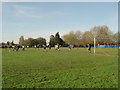
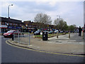
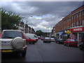
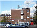
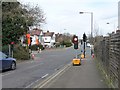
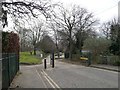
76 photos from this area
Area Information
Key information about the HA2 9ST including its size, population, and administrative classification.
- Area Type
- Postcode
- Area Size
- 8983 m²
- Population
- 1548
- Population Density
- 7544 people/km²
House Prices in HA2 9ST
21
Properties
£428,781
Average Sold Price
£45,000
Lowest Price
£695,000
Highest Price
Showing 21 properties
| Address | Type | Beds | Baths | Last Sale Price | Last Sale Date | |
|---|---|---|---|---|---|---|
| 13 Worple Close, Rayners Lane, HA2 9ST | Detached | 4 | 2 | £695,000 | Aug 2025 | |
| 21 Worple Close, Rayners Lane, HA2 9ST | Semi-detached | 3 | 1 | £690,000 | Nov 2023 | |
| 12 Worple Close, Rayners Lane, HA2 9ST | house | 3 | 1 | £640,000 | Jul 2022 | |
| 15 Worple Close, Rayners Lane, HA2 9ST | house | - | - | £540,000 | Feb 2021 | |
| 14 Worple Close, Rayners Lane, HA2 9ST | Semi-detached | 3 | 1 | £528,000 | Mar 2020 | |
| 1 Worple Close, Rayners Lane, HA2 9ST | Semi-detached | 4 | 3 | £660,000 | May 2019 | |
| 6 Worple Close, Rayners Lane, HA2 9ST | house | 3 | 1 | £540,000 | Mar 2018 | |
| 7 Worple Close, Rayners Lane, HA2 9ST | house | 3 | 2 | £465,000 | Jan 2014 | |
| 11 Worple Close, Rayners Lane, HA2 9ST | house | - | - | £375,000 | Nov 2012 | |
| 3 Worple Close, Rayners Lane, HA2 9ST | house | - | - | £397,500 | Jul 2007 |
Page 1 of 3
Energy Efficiency in HA2 9ST
Amenities
Schools
| Rank | School | Type | Entry gender | Ages |
|---|
Explore more schools in this area
Go to Schools tabDemographics
Household Size
Family (3-5 people)
most common
Accommodation Type
Houses
most common
Tenure
74
majority
Ethnic Group
asian_total
most common
Religion
N/A
most common
Household Composition
N/A
most common
Age
47
median
Adults (30-64 years)
most common
Household Deprivation
N/A
with no deprivation
NS-SEC
38
in Lower managerial occupations
Explore more demographic insights in this area
Go to Demographics tabPlanning
Planning Constraints
- Flood RiskPremium
- Ramsar Wetland SitesPremium
- Area of Outstanding Natural BeautyPremium
- Protected Nature ReservePremium
- Protected WoodlandPremium