Area Overview for HA2 9RD
Photos of HA2 9RD
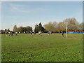
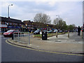
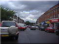
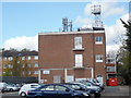
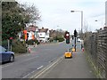
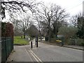
76 photos from this area
Area Information
Key information about the HA2 9RD including its size, population, and administrative classification.
- Area Type
- Postcode
- Area Size
- 1.5 hectares
- Population
- 1548
- Population Density
- 7544 people/km²
House Prices in HA2 9RD
46
Properties
£349,499
Average Sold Price
£47,500
Lowest Price
£640,000
Highest Price
Showing 46 properties
| Address | Type | Beds | Baths | Last Sale Price | Last Sale Date | |
|---|---|---|---|---|---|---|
| 92 Waverley Road, Rayners Lane, HA2 9RD | Terraced | 3 | 2 | £575,000 | Aug 2023 | |
| 62 Waverley Road, Rayners Lane, HA2 9RD | Semi-detached | 3 | 1 | £640,000 | Jan 2023 | |
| 28 Waverley Road, Rayners Lane, HA2 9RD | Terraced | 3 | 1 | £600,000 | Jun 2021 | |
| 44 Waverley Road, Rayners Lane, HA2 9RD | house | - | - | £473,000 | Jun 2021 | |
| 68 Waverley Road, Rayners Lane, HA2 9RD | Terraced | 3 | - | £510,000 | Oct 2020 | |
| 104 Waverley Road, Rayners Lane, HA2 9RD | Terraced | 3 | 2 | £521,007 | Nov 2019 | |
| 66 Waverley Road, Rayners Lane, HA2 9RD | Terraced | 3 | 1 | £460,000 | Jul 2019 | |
| 64 Waverley Road, Rayners Lane, HA2 9RD | Terraced | 3 | 2 | £555,000 | Dec 2018 | |
| 54 Waverley Road, Rayners Lane, HA2 9RD | Terraced | 4 | 2 | £350,000 | May 2018 | |
| 84 Waverley Road, Rayners Lane, HA2 9RD | Terraced | 3 | 1 | £480,500 | Nov 2017 |
Page 1 of 5
Energy Efficiency in HA2 9RD
Amenities
Schools
| Rank | School | Type | Entry gender | Ages |
|---|
Explore more schools in this area
Go to Schools tabDemographics
Household Size
Family (3-5 people)
most common
Accommodation Type
Houses
most common
Tenure
74
majority
Ethnic Group
asian_total
most common
Religion
N/A
most common
Household Composition
N/A
most common
Age
47
median
Adults (30-64 years)
most common
Household Deprivation
N/A
with no deprivation
NS-SEC
38
in Lower managerial occupations
Explore more demographic insights in this area
Go to Demographics tabPlanning
Planning Constraints
- Flood RiskPremium
- Ramsar Wetland SitesPremium
- Area of Outstanding Natural BeautyPremium
- Protected Nature ReservePremium
- Protected WoodlandPremium